In this section
The NASCOM communications network TIBs – MSFN Technical Information Bulletins updated Film: The Vital Link (1966) Audio: The Apollo 11 Descent and Landing Articles: A Look at Apollo Ground Support Control (Richard Stachurski 1972) From a slightly different perspective… (Tom Sheehan 2011)
People: Tom Sheehan – “Musings of an old Houston Track” (2004) Richard Stachurski – “Network” for the Apollo 11 Launch and Lunar Ascent
|
 |
|
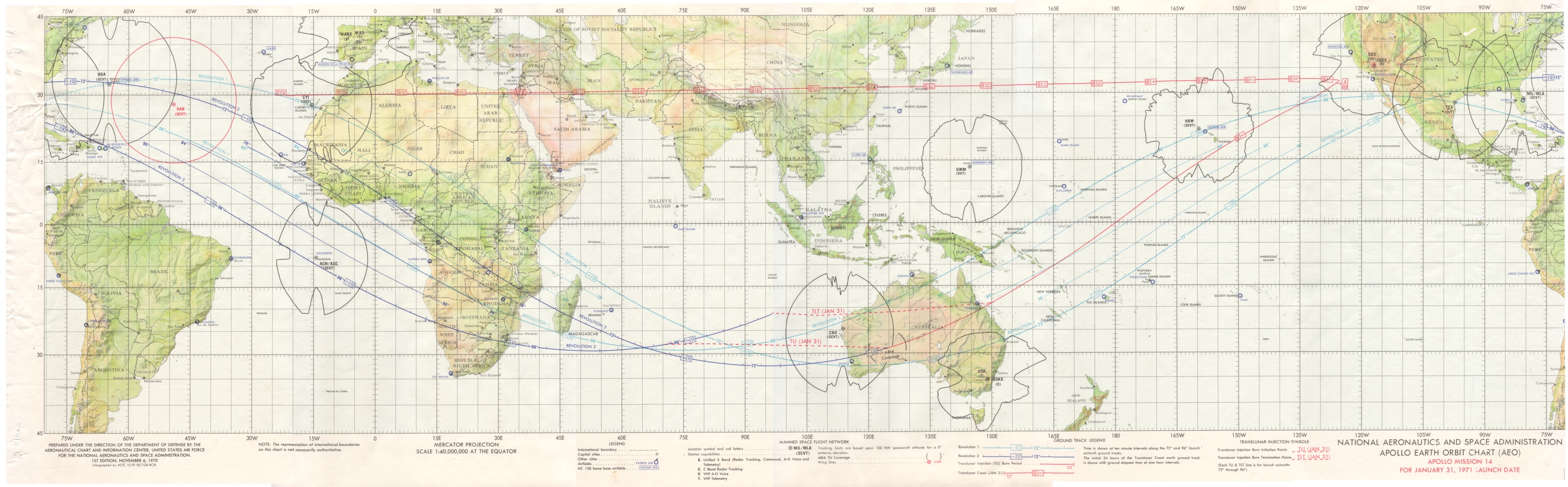
The Manned Space Flight Network TLI groundtrack map from Apollo 14. Bryan Sullivan preserved this map which was in the Honeysuckle Creek Operations Room. Note the terrain masks around each station – indicating the range at which a spacecraft in a 100 nautical mile orbit could be tracked. These terrain masks give a good idea of the terrain around each station. These also demonstrate the need for the tracking ships and the ARIA fleet during TLI and Re-entry. (The ARIA are not indicated on this map.) Hamish Lindsay adds: Scan: Colin Mackellar. |