Here’s a collection of aerial photos of the tracking station and Carnarvon township.
1. By Hamish Lindsay, 1966
2. From Lewis Wainwright’s photo album
3. From the Tidbinbilla archives.
4. By David Johns, 1972
1.) Aerial photos by Hamish Lindsay – 28 February 1966.
Hamish
writes, “I was flying in a light aircraft without the door on (the
pilot pulled fencing wire out of the hinges to remove the door!), and
when he banked to turn all my gear would slide towards the open door.”
In his diary entry for Monday 28 February 1966, Hamish writes,
“Went flying in a Cessna 175 for photographs of the station from the air.
Pilot was a Dick Scott who has only been up here 4 months. He took my side door off which made photography much easier.”
The photo set is a mixture of scans by Hamish from prints, and scans by Colin Mackellar from prints and medium format negatives. (Hence the inconsistent numbering and colour balance.)
|
Carnarvon Tracking Station from the air
Looking roughly south.
Click here for a 5.7MB PDF file. The PDF file has two pages – the second one is the same, but without the annotations.
Image scanned by Hamish Lindsay from a print. |
|
01. FPQ-6 Radar with Carnarvon township and the coast in the distance. Looking roughly WNW.
The North West Coastal Highway runs left to right.
Photo by Hamish Lindsay. 2022 scan from medium format negative by Colin Mackellar. |
|
02. Looking roughly west to the coast.
Photo by Hamish Lindsay. 2022 scan from medium format negative by Colin Mackellar. |
|
04. Carnarvon township in the distance.
Photo by Hamish Lindsay. 2022 scan from medium format negative by Colin Mackellar. |
|
03. A great view of Carnarvon Tracking Station, looking South.
FPQ-6 Radar in the right foreground. T&C Building in the distance at left.
Photo by Hamish Lindsay. 2022 scan from medium format negative by Colin Mackellar. |
|
03. Here’s a labelled version of the photo above. There’s quite a bit of detail on the negative.
Photo by Hamish Lindsay. 2022 scan from medium format negative and labels by Colin Mackellar. |
|
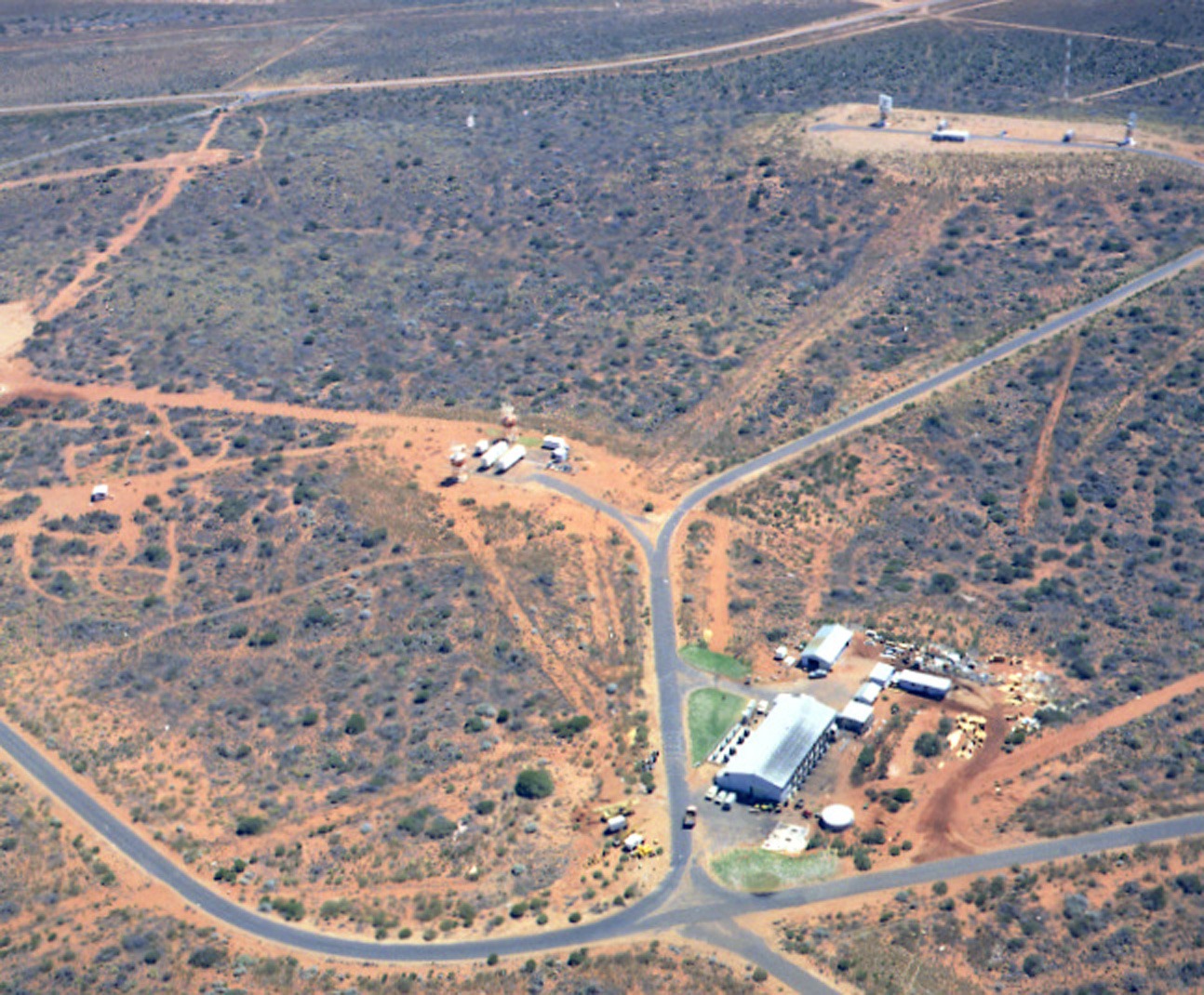
8. The power house with the Gemini Command and Voice transmitters site beyond to the left, and the Range and Range Rate site in the distance.
Photo and scan by Hamish Lindsay. |
|
8b. Aerial view – Apollo configuration. Hamish writes:
“On the left are the two tropospheric scatter
dish antennas for a link to Geraldton, introduced when all the land lines
out of Carnarvon were lost to a lightning strike early in the Gemini Program.
Next is the 9-metre USB Apollo antenna.
The big building is the T & C (Telemetry and Control)
building, with the Apollo extensions visible nearest the camera with its
battery of airconditioning units needed to compete with the heat of the
surrounding desert.
At the top right corner of the T&C building are
the two Gemini Acquisition Aid antennas, while the old Verlort radar from Muchea with its vans and small concrete tower is visible in
the top right of the picture.”
The powerhouse and FPQ-6 radar were established
in separate locations.
At its peak Carnarvon (CRO) was the largest tracking
station outside the USA.”
Photo and scan by Hamish Lindsay. |
|
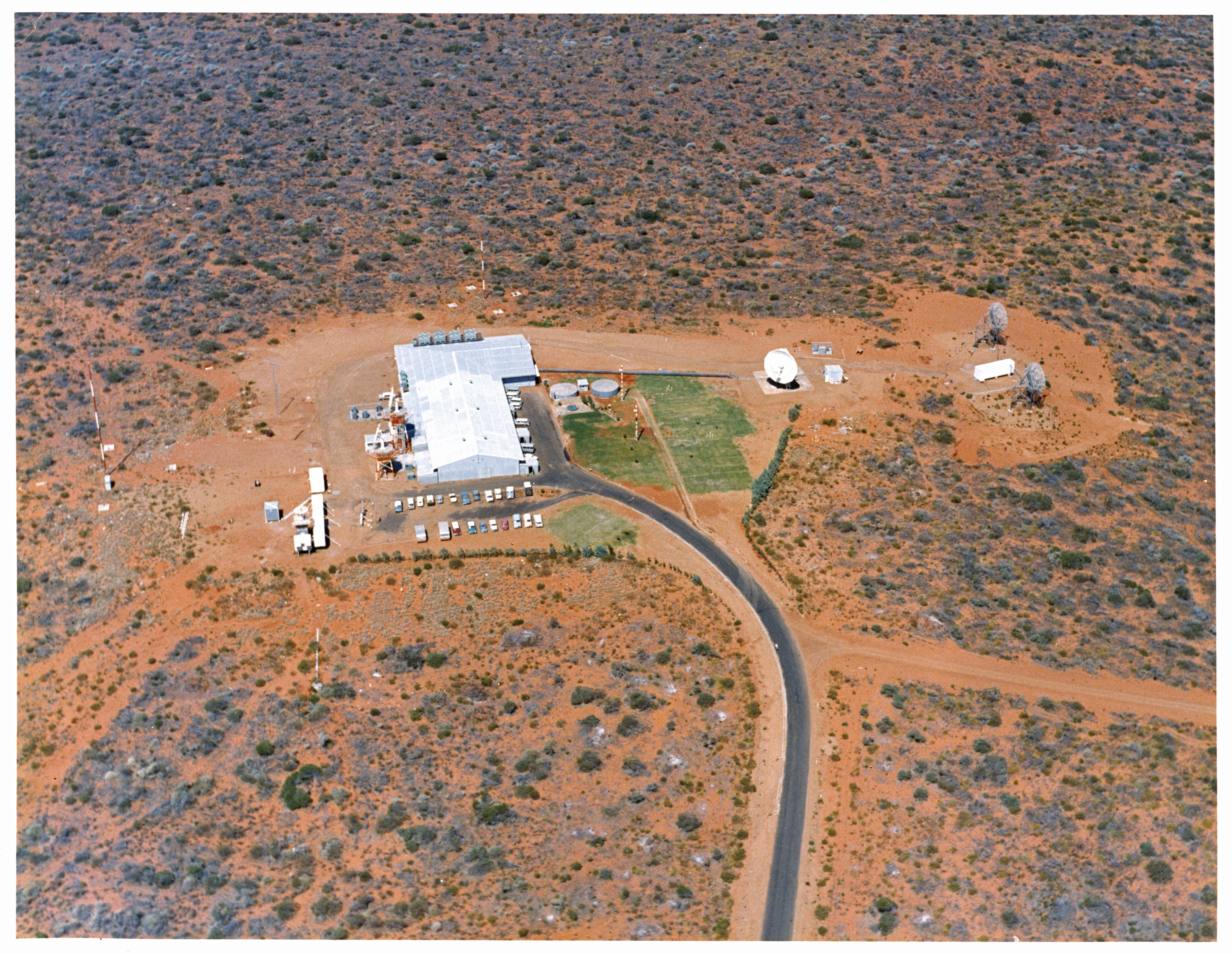
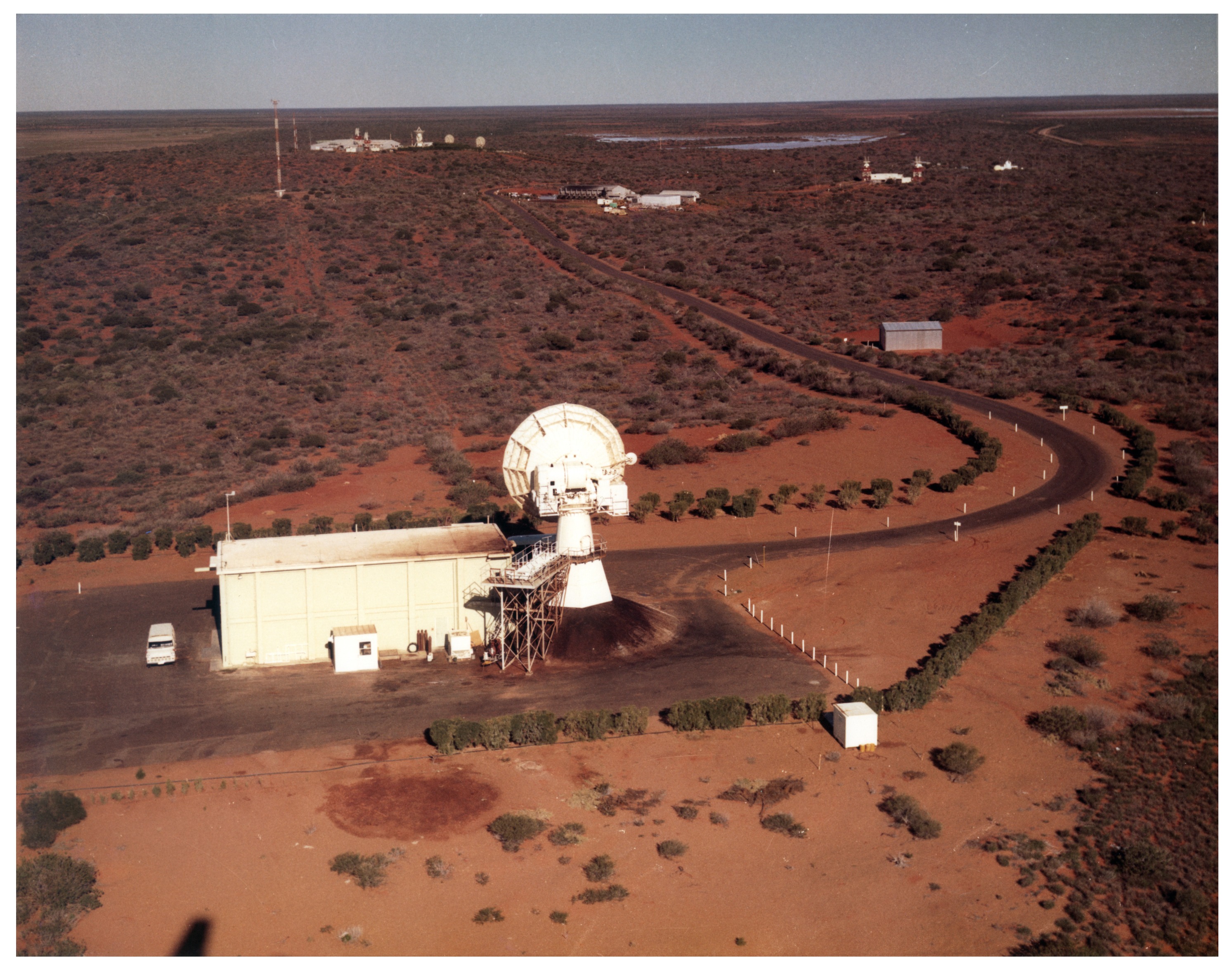
05. The T&C Building and USB antenna.
Note Monte Sala’s AWA Gemini fountain.
Photo by Hamish Lindsay. 2022 scan from medium format negative by Colin Mackellar. |
|
8c. Visible in this photo is the T&C Building – the new Apollo extension is at the top of the picture.
To the right is the 9 metre USB antenna, and to right of it are the troppo-scatter antennae for communications to Geraldton.
Photo by Hamish Lindsay. 2020 scan from print by Colin Mackellar. |
2.) Aerial photos of the station and township from Lewis Wainwright’s album.
|
The T&C Building and USB antenna.
Photo from the album presented to Station Director Lewis Wainwright at his farewell in 1968.
With thanks to Kevin Wainwright. Scan by Colin Mackellar. |
|
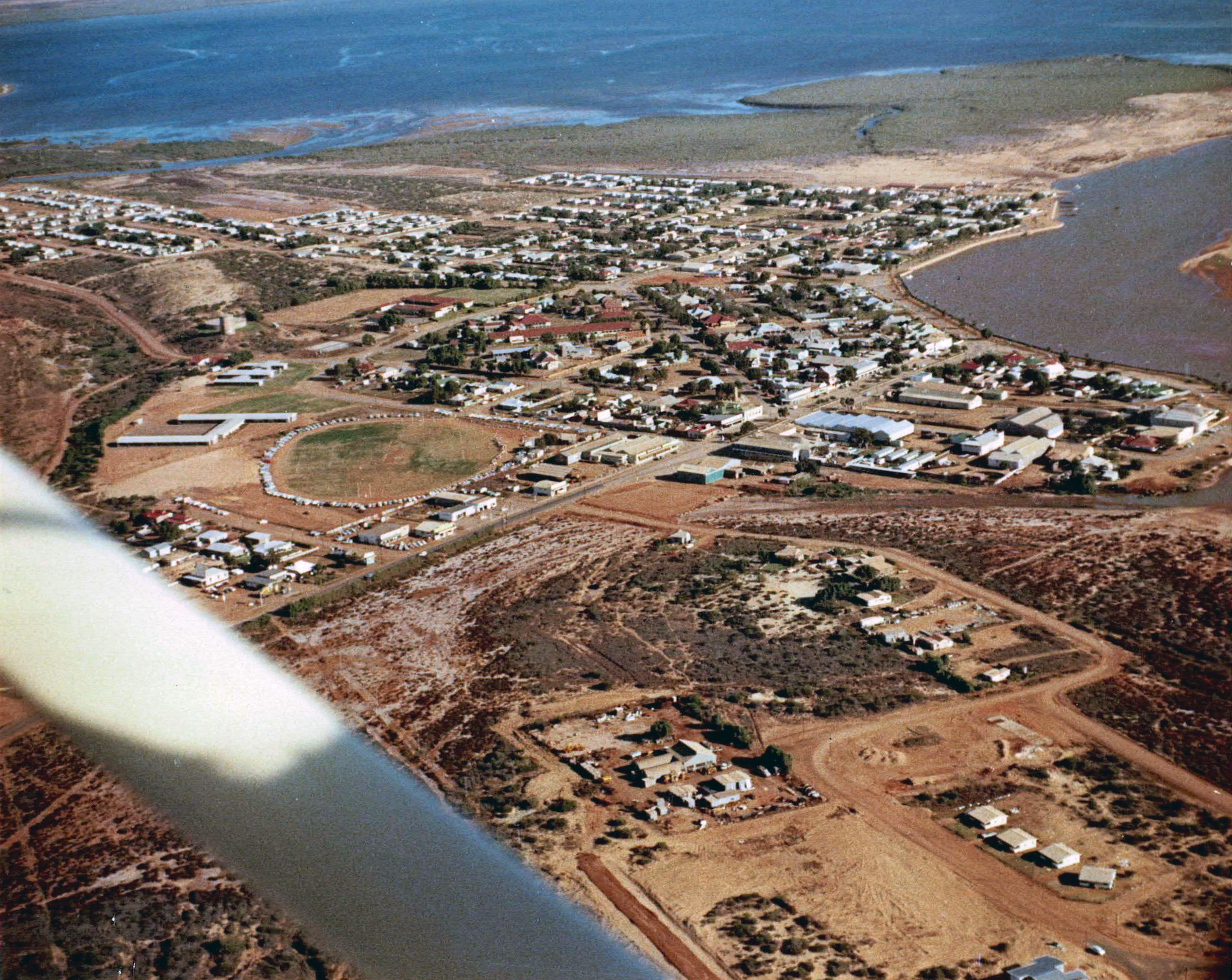
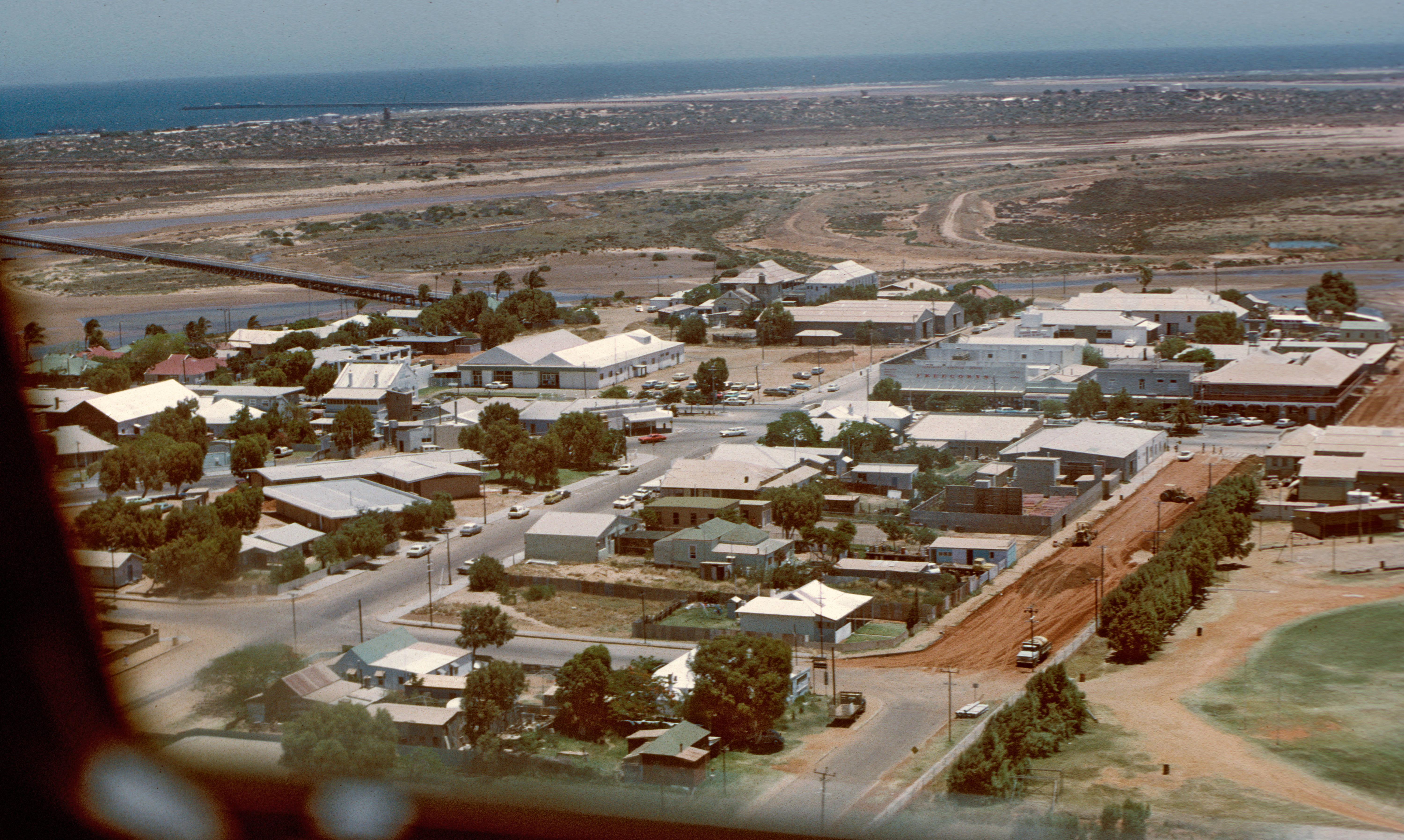
Carnarvon township, looking south.
Robinson Street, the main business thoroughfare runs diagonally from lower left to centre right.
Photo from the album presented to Station Director Lewis Wainwright at his farewell in 1968.
With thanks to Kevin Wainwright. Scan and enhancement by Colin Mackellar. |
|
Carnarvon township, looking south east.
Robinson Street, the main business thoroughfare runs diagonally at the bottom of the picture. The Fascine (i.e. the wooden retaining fence at the water’s edge of the mouth of the Gascoyne River) is just visible in the bottom right corner.
Photo from the album presented to Station Director Lewis Wainwright at his farewell in 1968.
With thanks to Kevin Wainwright. Scan and enhancement by Colin Mackellar. |
3.) Aerial photos from the Tidbinbilla archives.
Scanned by Glen Nagle.
|
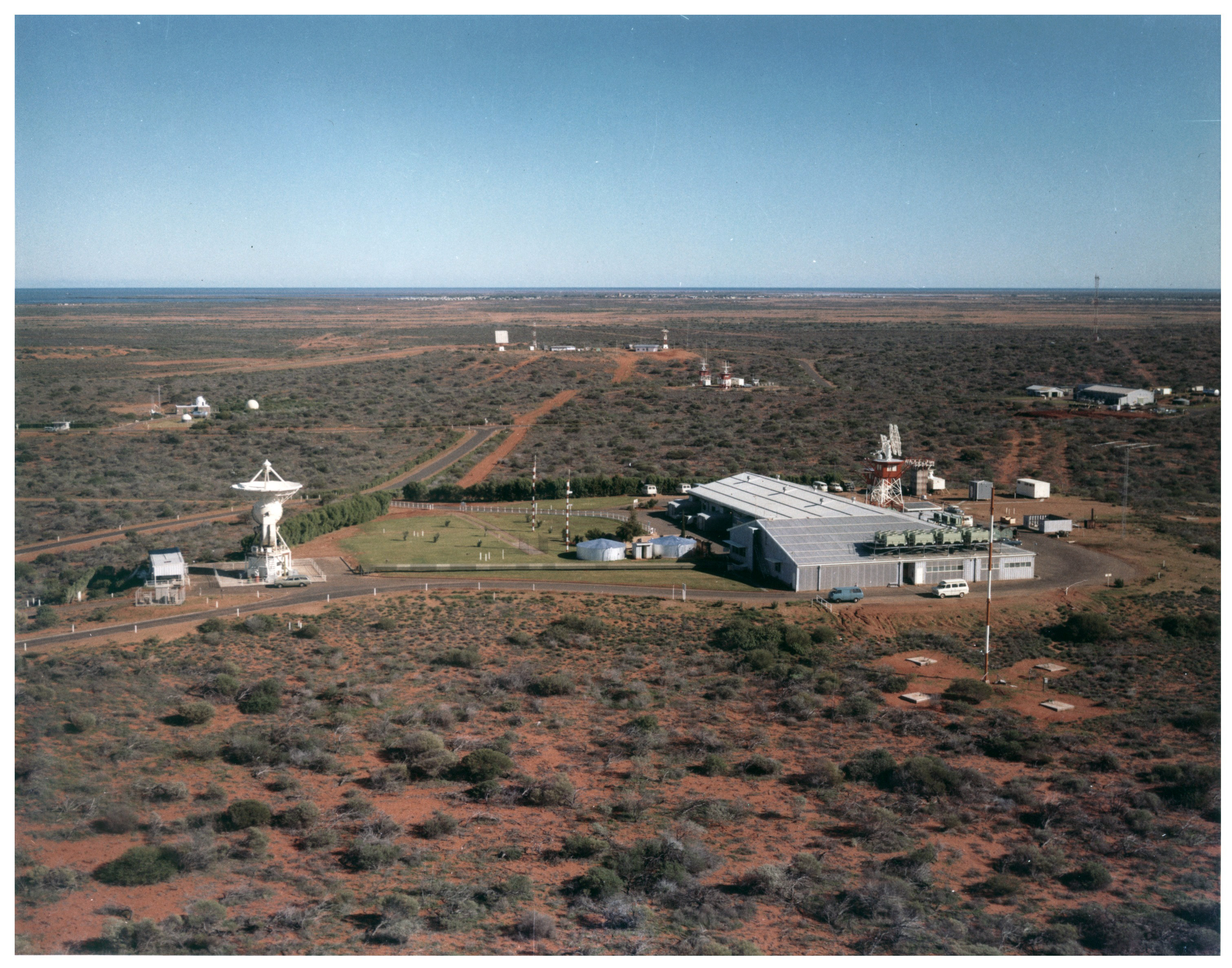
Aerial view – Apollo configuration – looking South West.
USB antenna on left, T&C Building on right.
Large (1.7MB), Larger (6.1MB).
Photo from the Tidbinbilla archives, scan by Glen Nagle. |
|
Aerial view – Apollo configuration – looking South East.
The FPQ-6 Radar. The T&C Building and USB antenna are visible in the distance, left of centre.
Large (1.4MB), Larger (5.2MB).
Photo from the Tidbinbilla archives, scan by Glen Nagle. |
4.) Aerial photos by David Johns, 1972.
In November 1972, Super Constellation NASA 421 made its last simulation flight to Australia, prior to Apollo 17, the last lunar flight of the Apollo Program.
Since NASA 421 was too heavy to land at Carnarvon airport, the aircraft would start its simulations by leaving Perth in the very early morning (pre-dawn), spend the day flying a pattern over Carnarvon, and then return to Perth late in the day.
Carnarvon SPAN’s David Johns gained permission to fly on this mission and drove to Perth to join the aircraft there. (Read all of David’s fascinating story here.)
As this was the last planned flight of a Super Constellation to Carnarvon, local air traffic controllers gave permission for low level passes of the tracking station (less than 200 feet!) and also authorised a low pass of the Carnarvon township. It must have caused quite a stir.
Photos by David Johns. Some image cleanup by Colin Mackellar.
|
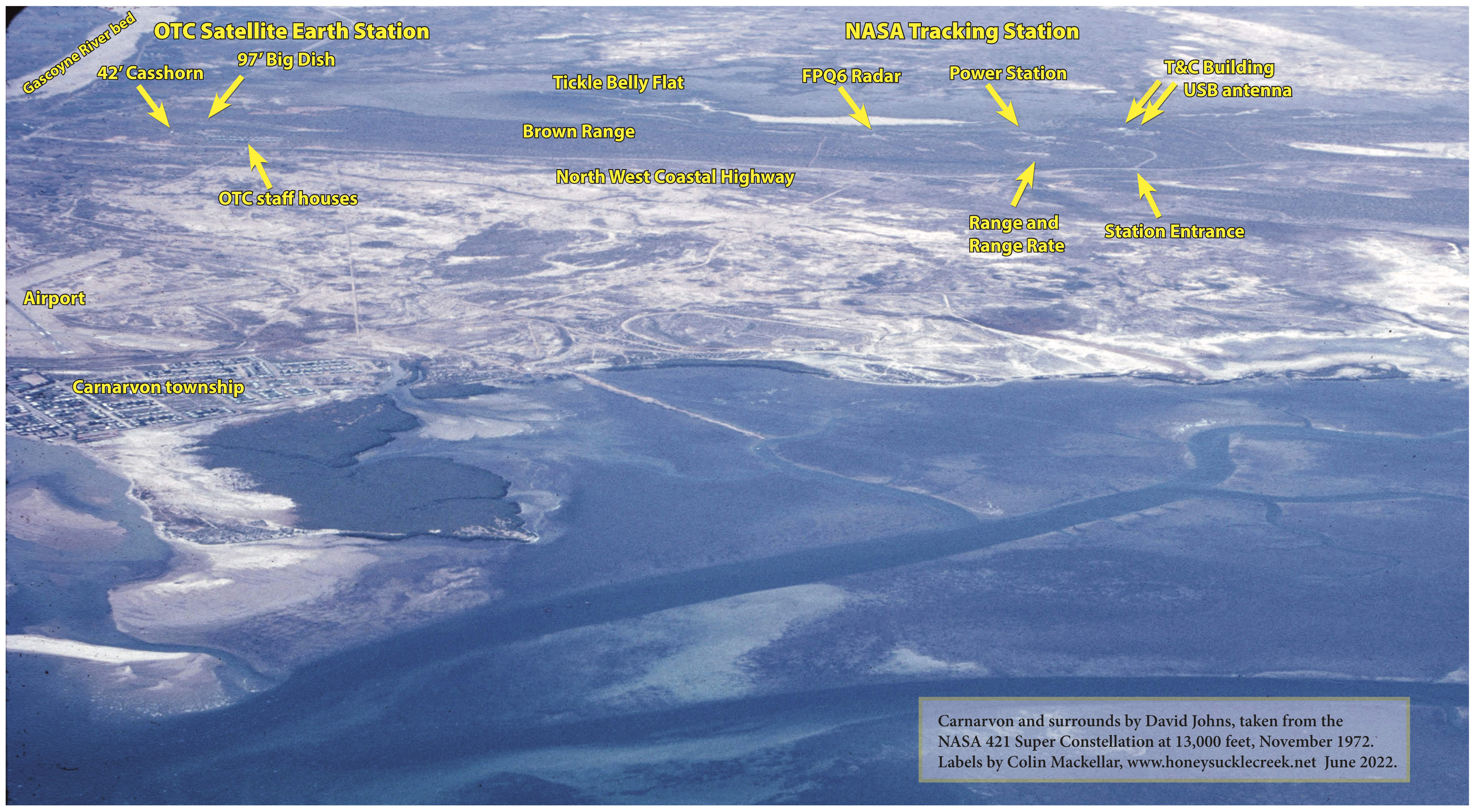
Carnarvon township and the OTC and NASA stations.
Photo taken from Super Constellation NASA 421 as it was flying simulation passes at 13,000 feet off the coast of Carnarvon in November 1972.
Here’s the photo without labels. |
|
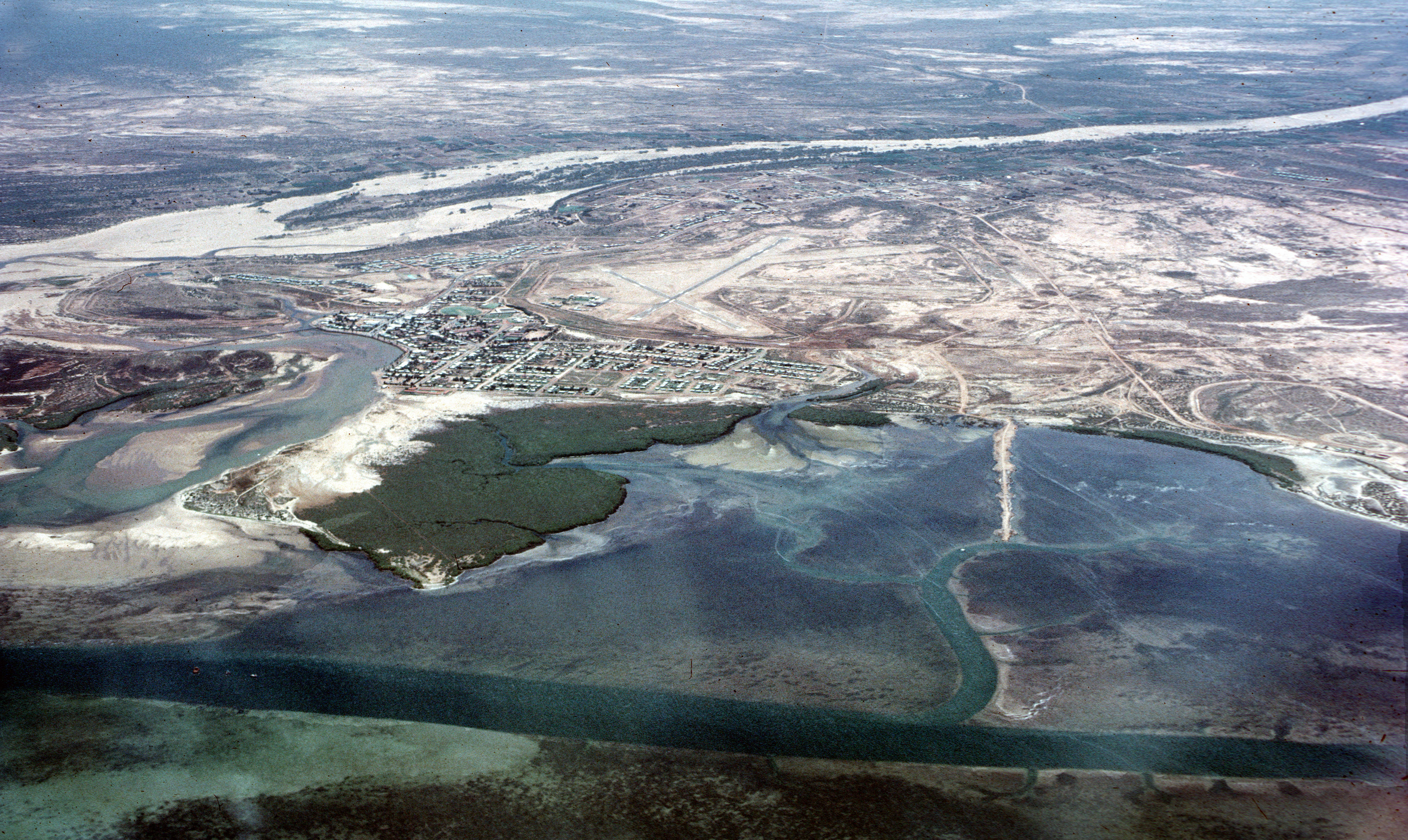
Carnarvon township as well as the Gascoyne dry river bed and the coast to the south.
Photo taken from Super Constellation NASA 421 at 13,000 feet. |
|
Carnarvon township as well as the Gascoyne dry river bed looking roughly east. The OTC site is just visible in the distance on the right of the frame.
Photo taken from Super Constellation NASA 421 at 13,000 feet. |
|
Carnarvon township as well as the Gascoyne dry river bed looking roughly east.
|
|
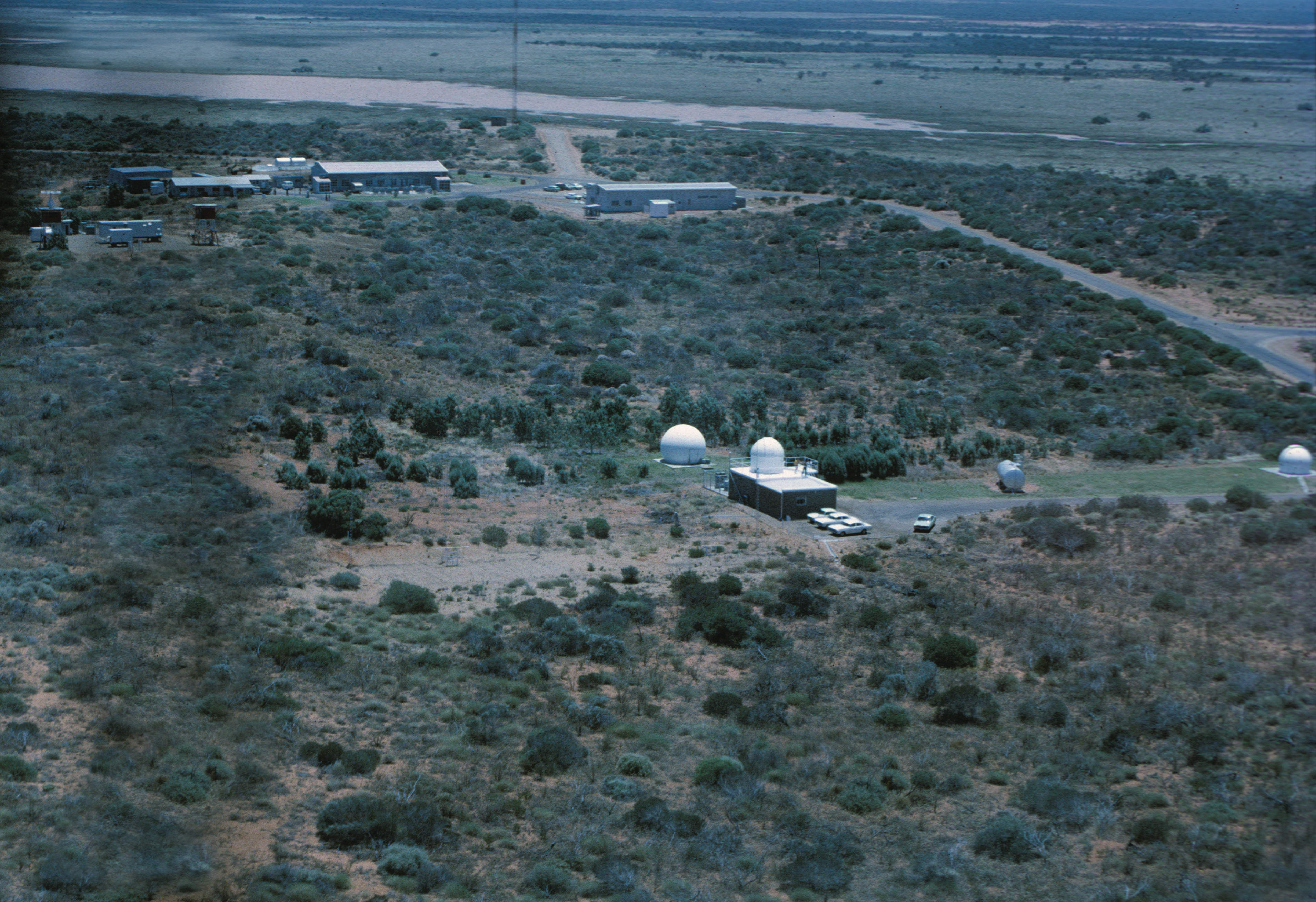
NASA 421 made three low passes over the tracking station.
At centre of frame is SPAN (the Solar Particle Alert Network) where David worked. Above it is the logisitics building, and to the left of that, the Power House and related buildings. |
|
In this second pass more of the SPAN staff have come out to see the Super Constellation fly past
Near the top of picture on the right is the UHF Command site, and above it on the horizon, the OTC Satellite Earth Station.
The FPQ-6 Radar is just below it and to the right, pointing straight at the aircraft. |
|
Carnarvon Tracking Station T&C Building. Many staff members are outside to see the spectacle.
|
|
Carnarvon Tracking Station T&C Building, apparently on the second pass. Many staff members are outside to see the spectacle, with several taking photos.
Photo was taken looking out of a left hand window as the aircraft travels from left to right. The edge of the 9 metre (30 foot) USB antenna is just visible at right of frame. |
|
Carnarvon Tracking Station at just above the height of the 30 foot Unified S-Band antenna. Photo was taken looking out of a left hand window as the aircraft makes a sweeping left-hand turn. |
|
NASA 421 on a very low pass just to the south of the Unified S-Band antenna.
Photo by Paul Oates. |
|
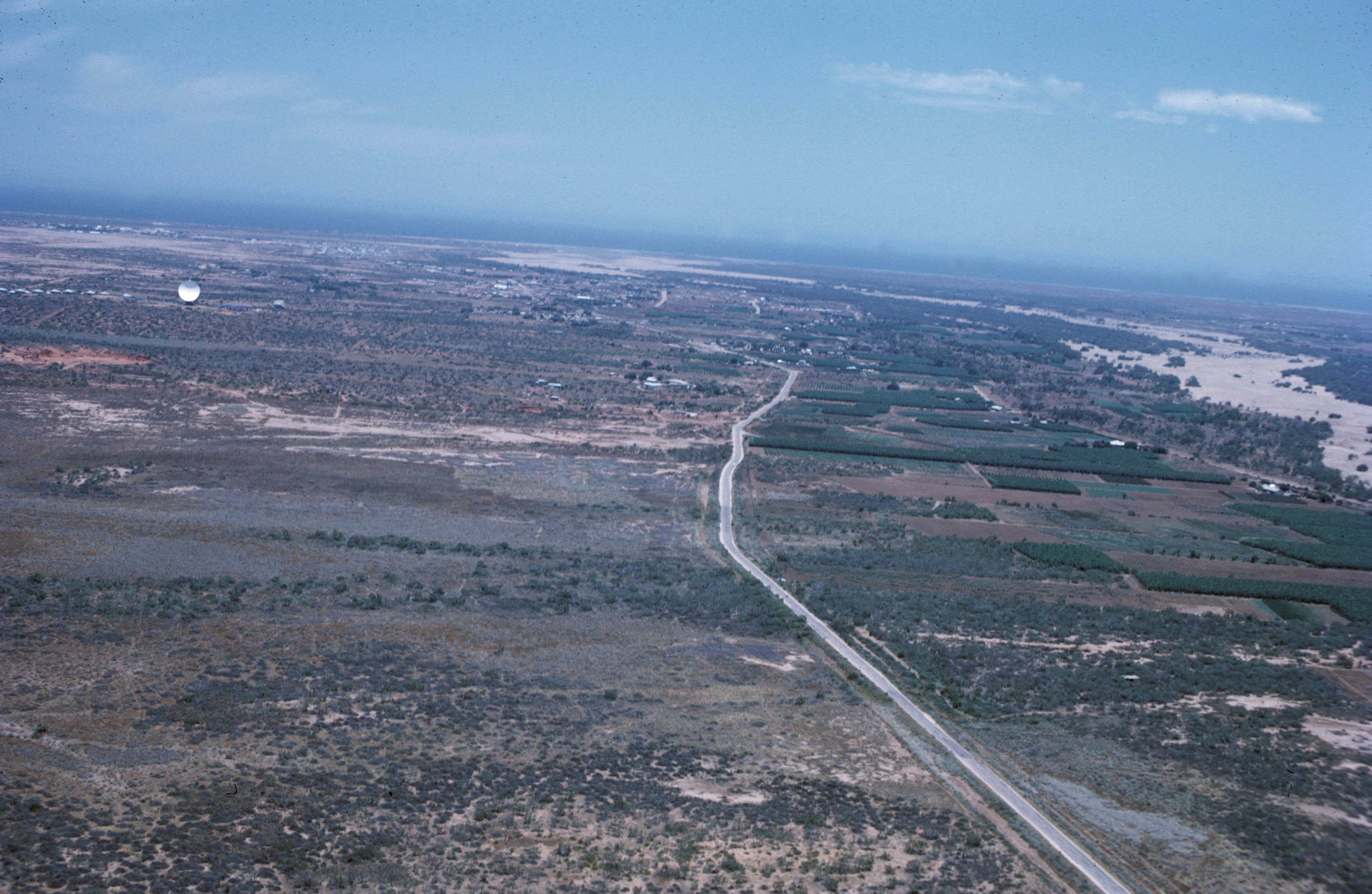
NASA 421 is about to cross the North West Coastal Highway about to turn west, approx. 12km NE of the town and 6 km from the OTC Satellite Earth Station.
The OTC 97 foot “Big Dish”, 42 foot Casshorn antenna, as well as the staff houses, are visible at left of frame. The Gascoyne River bed is on the right. |
|
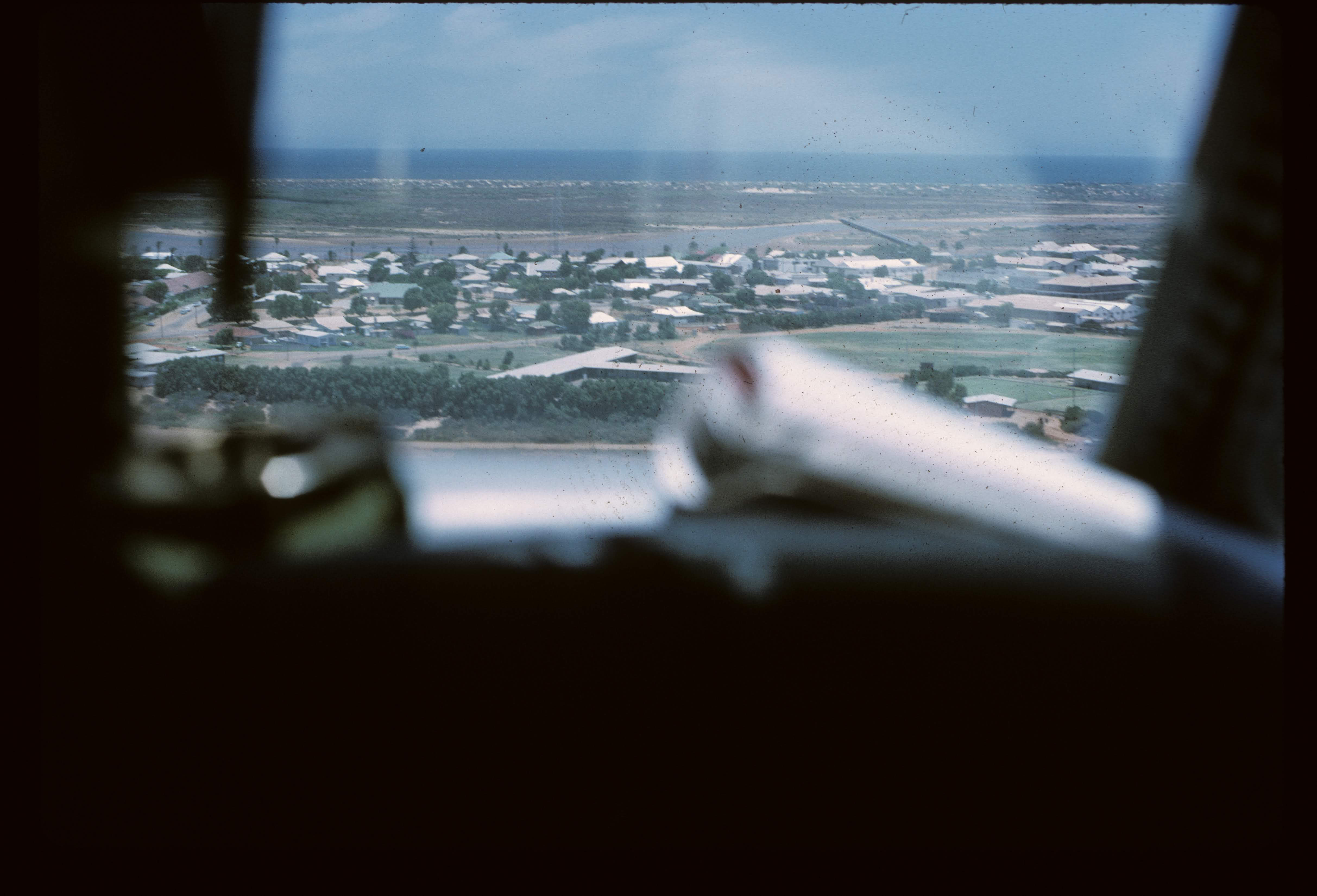
Now about 600 feet (200 metres) above the Gascoyne River bed, 2.5km from the OTC Satellite Earth Station (which is obscured behind the pillar at left) with Carnarvon township in the centre distance 7km away. |
|
The OTC Satellite Earth Station’s 97 foot “Big Dish” and OTC staff housing. The 42 foot Casshorn is just out of frame to the right.
The NASA Tracking Station is visible along Brown Range in the top left of the frame. The FPQ-6 Radar appears to be tracking the aircraft (as it was in one of the photos above). |
|
Carnarvon airport ahead as NASA 421 comes in for a low pass. |
|
Carnarvon township as the aircraft flies low above the airport. |
|
Carnarvon township, looking north west.
Robinson Street runs left–right across the picture.
Tuckey’s Port Hotel is on the right of the picture on Robinson Street. |