Located in the South Atlantic Ocean, approximately 8,100km downrange from Cape Kennedy, Ascension Island Tracking Station was a key site for determining the initial orbit of an Apollo spacecraft. It was the most remote of the NASA tracking stations.
|
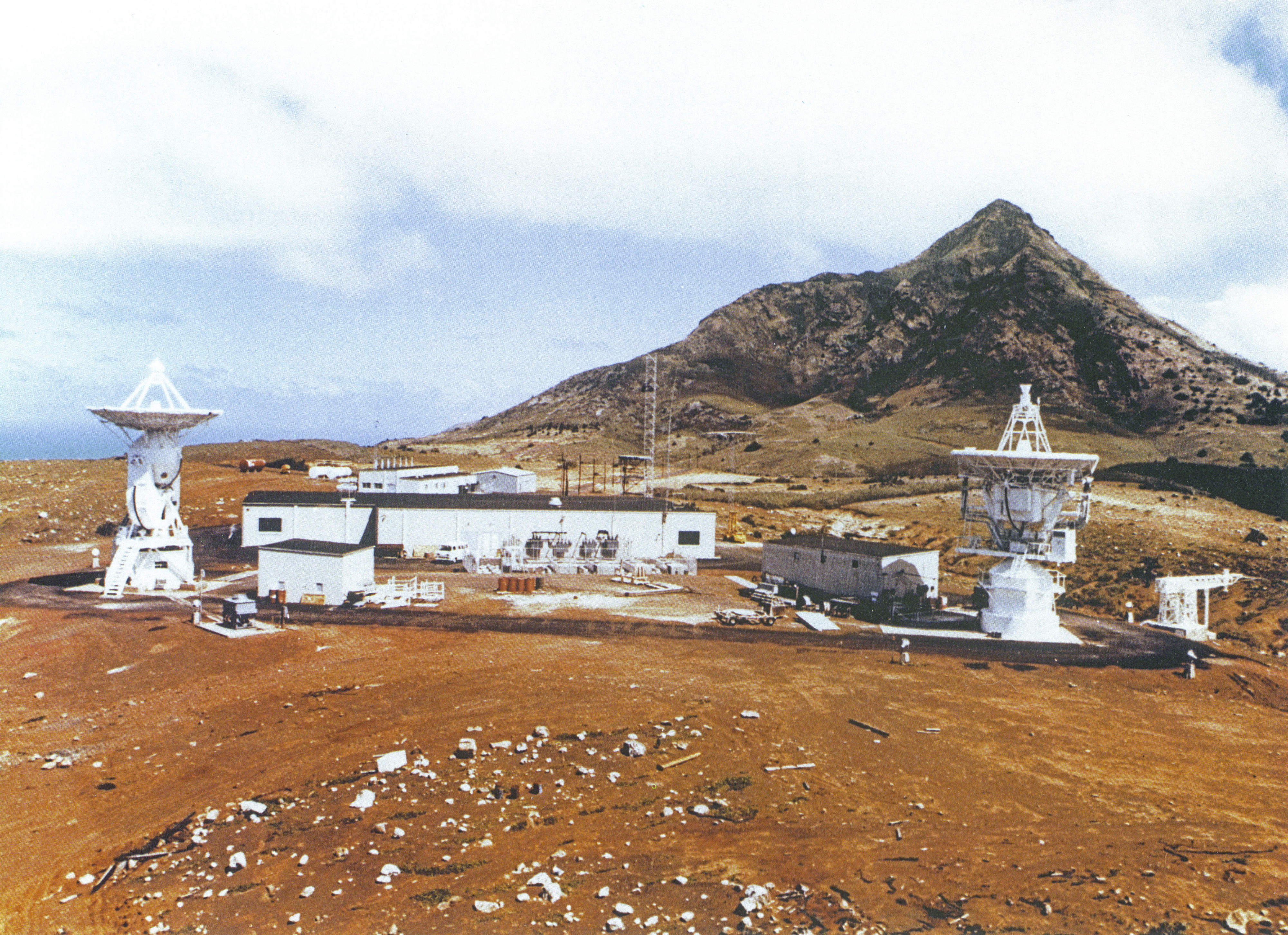
The Ascension Island Tracking Station at Devil’s Ashpit, near the eastern corner of Ascension Island.
The MSFN 9 metre USB antenna (network designation ACN) is at left, the DSN 9 metre antenna is at right. The Acquisition Aid is just visible at centre, behind the Operations building. The dramatic peak is “The Peak”, rising to 859 metres on Green Mountain, the highest point on the island.
Photo from Picture Album of the Deep Space Network,
Jet Propulsion Laboratory, compiled by N. A. Renzetti and D. Worthington, July 1, 1994. With thanks to Mike Dinn. Scan by Colin Mackellar. |
The station was located at an altitude of 530m ASL in the barren Devil’s Ashpit area – on the opposite side of the Island to the settlements and the Air Force Eastern Test Range radars.
It was a dual station, with a smaller Deep Space Network wing on the eastern side of the Operations Building. 9 meter antennae were built for both the MSFN and the DSN uses – construction began in 1965.
|
Green Mountain lies shrouded in clouds in this March 2002 photo taken by Syd Buxton.
Syd was onboard a Royal Air Force VC10 K4 tanker. For orientation, see the map – this view from a point due east of the island. More photos here.
The NASA station (gone by the time this was taken) was just to the left of centre, beneath the clouds. |
This outline of the station was published in Picture Album of the Deep Space Network, Jet Propulsion Laboratory, compiled by N. A. Renzetti and D. Worthington, July 1, 1994.
“An integrated Apollo and deep space station (DSS 72) was constructed from 1965 to 1966 on the British island of Ascension, in the Atlantic Ocean, approximately 2,250 kilometers (1,400 miles) east of South about 4,000 miles down the Air Force Eastern Test Range (ETR).
The original purpose of constructing this station was to support the early Surveyor missions, whose Atlas-Centaur launch vehicles would produce a direct-ascent trajectory to the Moon, rather than insertion from a parking orbit.
Translunar injection would therefore occur before the spacecraft was visible to either the Johannesburg station or the stations in Spain. Consequently, a station nearer to the launch site than these facilities was needed to obtain during this phase positional data vital to trajectory determination and midcourse corrections.
Because such a station could also support later deep space missions and Apollo manned missions, NASA decided to build an integrated facility (with a joint-control building) serving both programs.
A site survey conducted by Goddard Space Flight Center personnel in April 1964 on Ascension Island, where an ETR station was already established, identified a suitable site at Devil’s Ashpit, on the eastern side of the island. Volcanic peaks surrounding the site provided natural shielding against radar and other radio-frequency interference from the ETR station and a British broadcasting facility elsewhere on the 88-square-kilometer (34-square-mile) island.
Deep space and Apollo missions were separately monitored by two 9-meter, az-el-mounted antennas with high angular-tracking rates. The deep space antenna had a nominal communications range of 60,300 kilometers (37,500 miles). This station was funded by the U.S. State Department.”
|
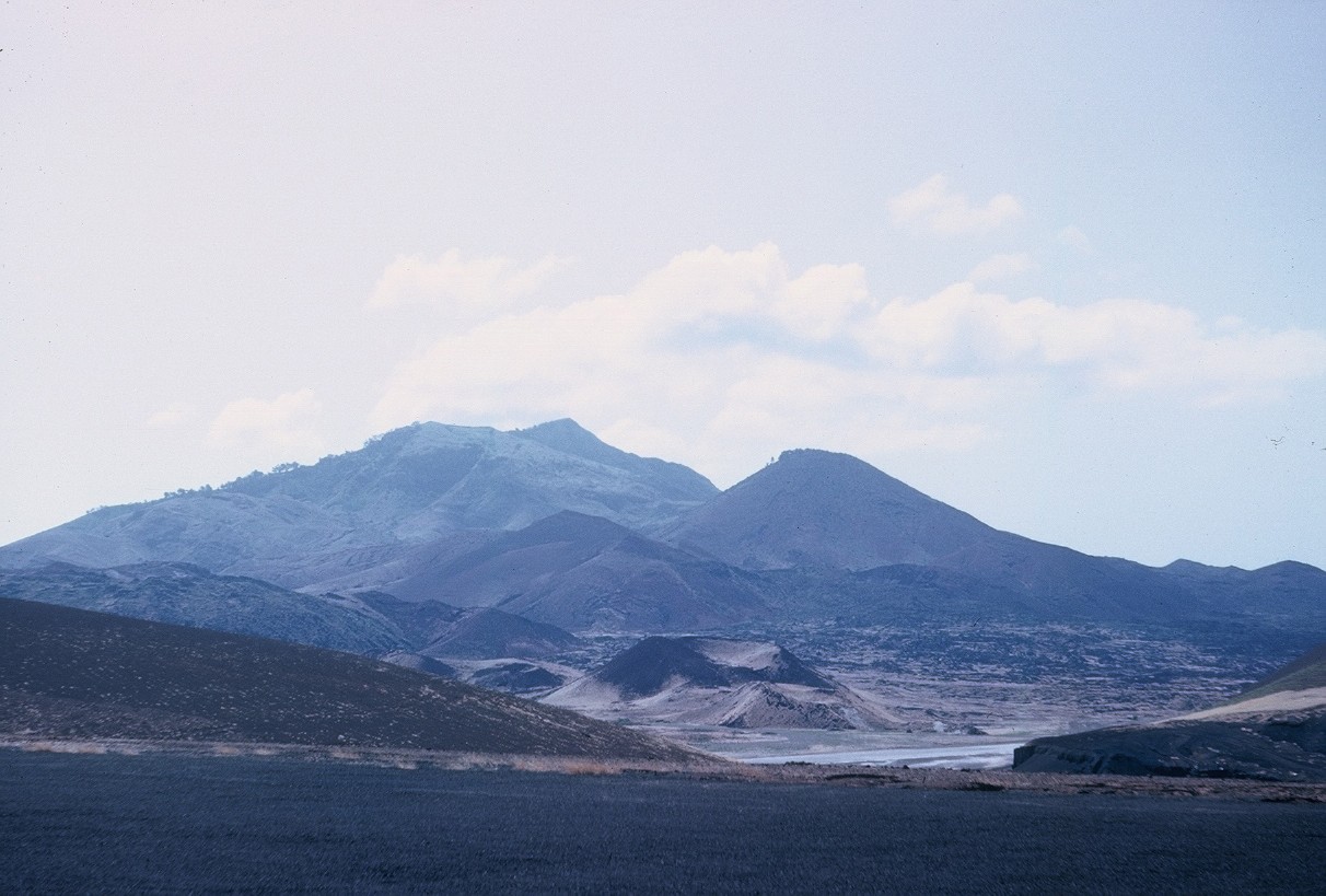
Green Mountain – as seen from the edge of the COTAR field near the airstrip – larger version here – largest version here.
The NASA MSFN / DSN station was built on the far side of Green Mountain to minimise any possible interference from the AFETR radar.
Photo: Tom Sheehan. |
Bendix personnel staffed the station and were housed at the US Air Force base near Wideawake Airfield. Ascension was the only MSFN station which was designated “singles-only” – the island was too remote to bring families.
The Ascension Island station was built for Apollo but was ready in time to support the last of the Gemini flights.
In 1969, the Station Director was Donald Dunsmore, M&O Supervisor James Murphy, Assistant M&O Mel Fetzer.
in 1971, the Station Director was Jeff Speck.
Other Ascension people were –
Operations Supervisor B. Currin; Communications Systems supervisor R. Tucker; Data Systems supervisor H. Donnally; Telemetry Lead Engineer J. Jarboe; Lead Engineer L. Hoppe; Acquisition Aid lead engineer J. Kenworthy; TDP/APP lead engineer C. Snyder; and Digital Ranging lead engineer L. Parker. (source: Goddard Technical Information Bulletin, 20 July 1969.)
Ascension also supported Skylab. It later joined the STDN and was closed in the 1990s (exact date uncertain).
The Operations building was still standing in 2007, and was apparently being used by the Scouts.