Before they were Space Trackers
Before involvement in the space program, many space trackers had interesting careers in other pioneering areas, including in Antarctica. It’s not surprising that men with technical skills and a sense of adventure would work in both spheres of research.
Here are four space trackers who not only worked in Antarctica, but also had geographical features named after them. (Are there others? Please make contact.)
Details of the features named for the first three men is published in Geographic Names of the Antarctic, Names Approved by the United States Board on Geographic Names, compiled and edited by Fred G. Alberts. Second Edition 1995.
Available online from The U.S. Geological Survey. 116MB PDF file.
|
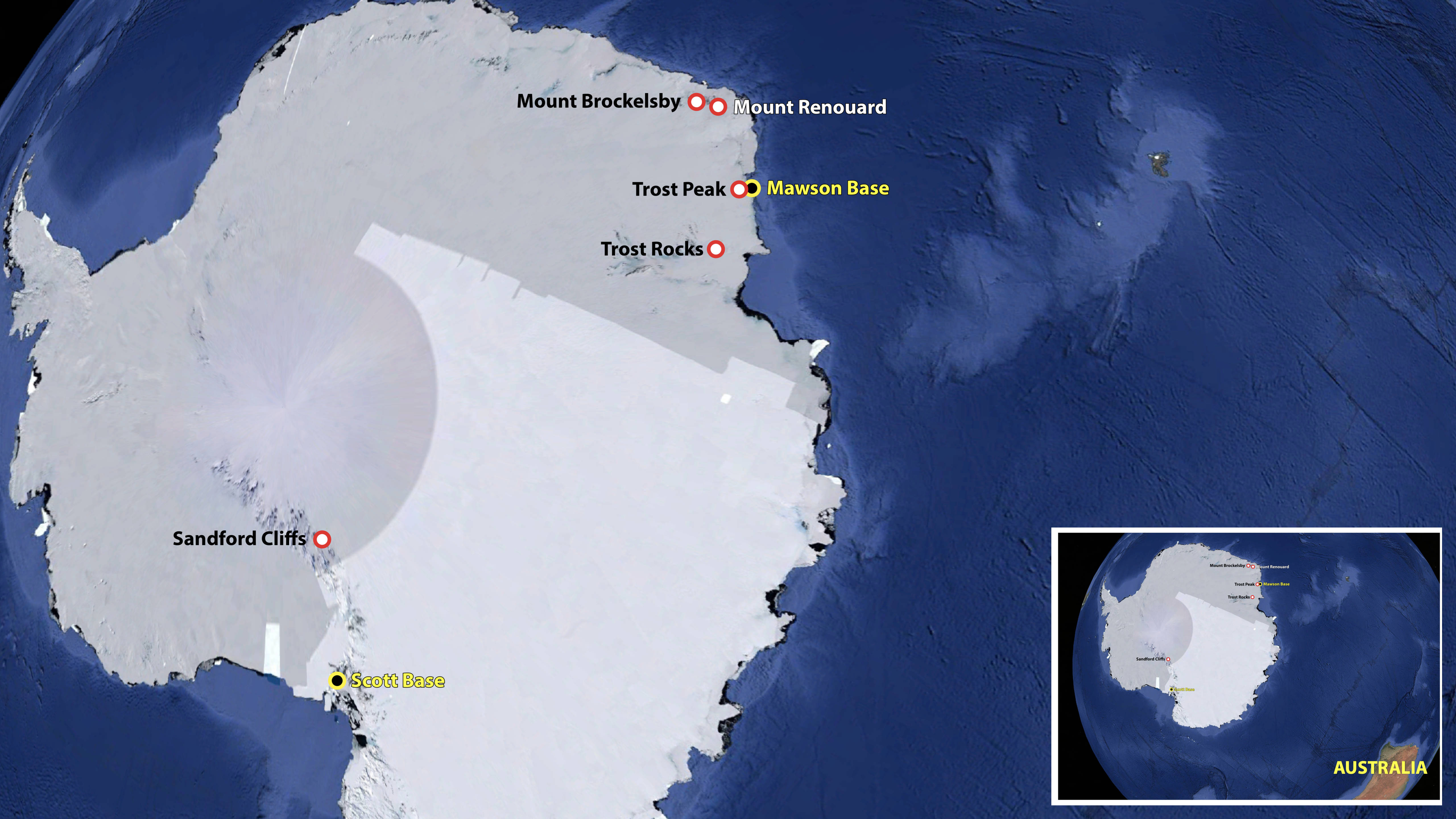
Geographic features named for our future space trackers.
Base image: Google Earth. Map: Colin Mackellar.
|
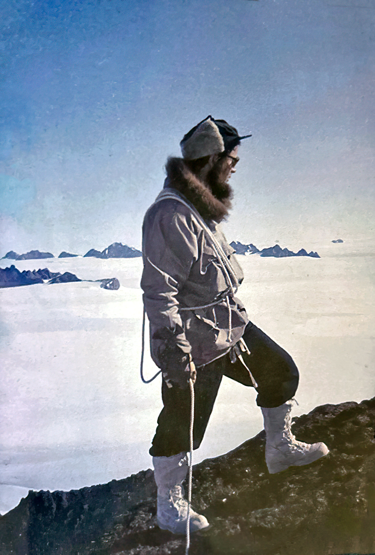
1.) Neil Sandford.
|
Neil Sandford (nursing some kind of injury) standing outside Scott’s Hut in 1957.
Scott’s hut was built at Cape Evans on Ross Island in Antarctica in 1911 by the British Antarctic Expedition of 1910–1913 led by Robert Falcon Scott. It had been unused since 1917 and was only dug out of the ice and snow in 1956 by personnel from the nearby American base.
Scan: Colin Mackellar.
|
New Zealander Neil Sandford served with distinction at Cooby Creek, Honeysuckle Creek and Tidbinbilla – but before he came to Australia, he was been a member of the 23-man 1956-1958 New Zealand Antarctic expedition. He spent 15 months in Antarctica.
Five members of the team (Trevor Hatherton, Vern Gerard, Peter MacDonald, Herb Orr and Neil Sandford) were to conduct observations as part of the International Geophysical Year, and others – led by Sir Edmund Hillary – were part of the Commonwealth Antarctic Expedition and continued to the South Pole.
Neil operated equipment to help understand the ionosphere, and – as an amateur radio operator – was a key member of the team maintaining CW (Morse Code) communications with New Zealand.
Notably, Neil helped to establish New Zealand’s Antarctic base, Scott Base, during the summer of 1956/57.
|
Neil Sandford took early 1957 this photo of Scott Base, A to F huts, from a position on the ionosonde pole. Note Neil’s shadow just left of centre.
Scanned and assembled by Colin Mackellar from two of Neil’s medium format negatives.
|
|
Neil Sandford making gravity observations on a wooden pier inside Magnetic Hut on Wind Vane Hill at Cape Evans on Ross Island. (Magnetic Hut was built by Scott’s British Antarctic Expedition of 1910-1913. No iron fastenings were employed so that the hut could be used for magnetic observations.)
Scanned from Neil’s medium format negative by Colin Mackellar.
|
|
Weighing huskies at Scott Base, 1957.
Photo: Neil Sandford. Scan: Colin Mackellar.
|
|
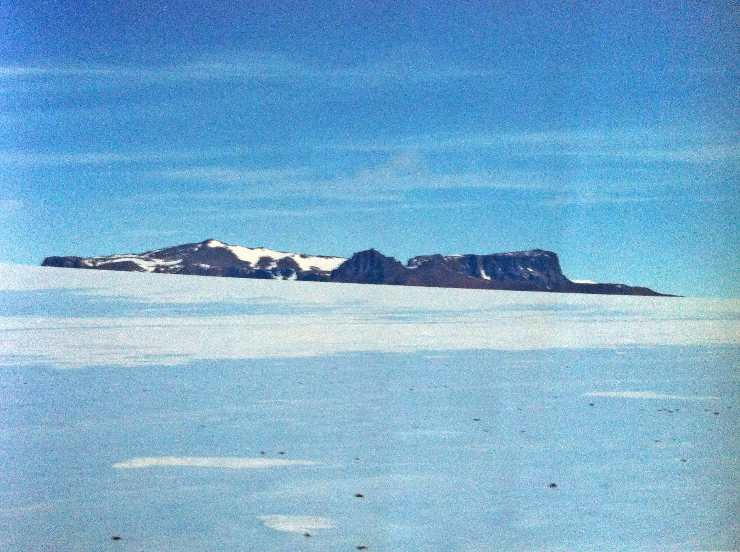
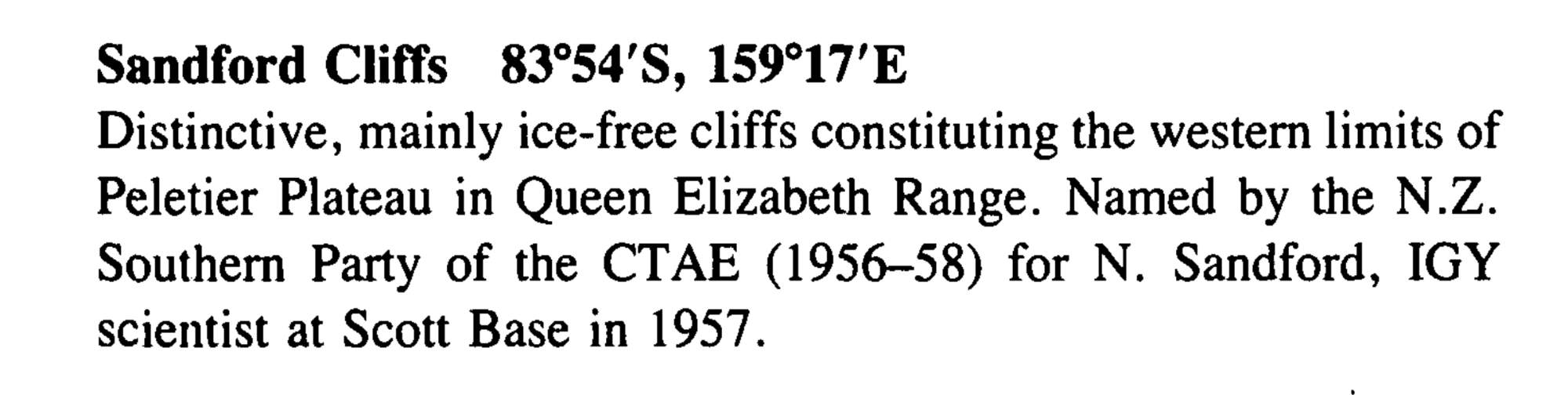
Sandford Cliffs.
Photo via Neil Sandford.
|
|
Sandford Cliffs entry from Geographic Names of the Antarctic.
|
Part of a 2013 interview with Neil is available on this page. The plan is to publish the full interview and many photos when time permits. (Sorry for the extended delay!)
2.) Ed von Renouard.
|
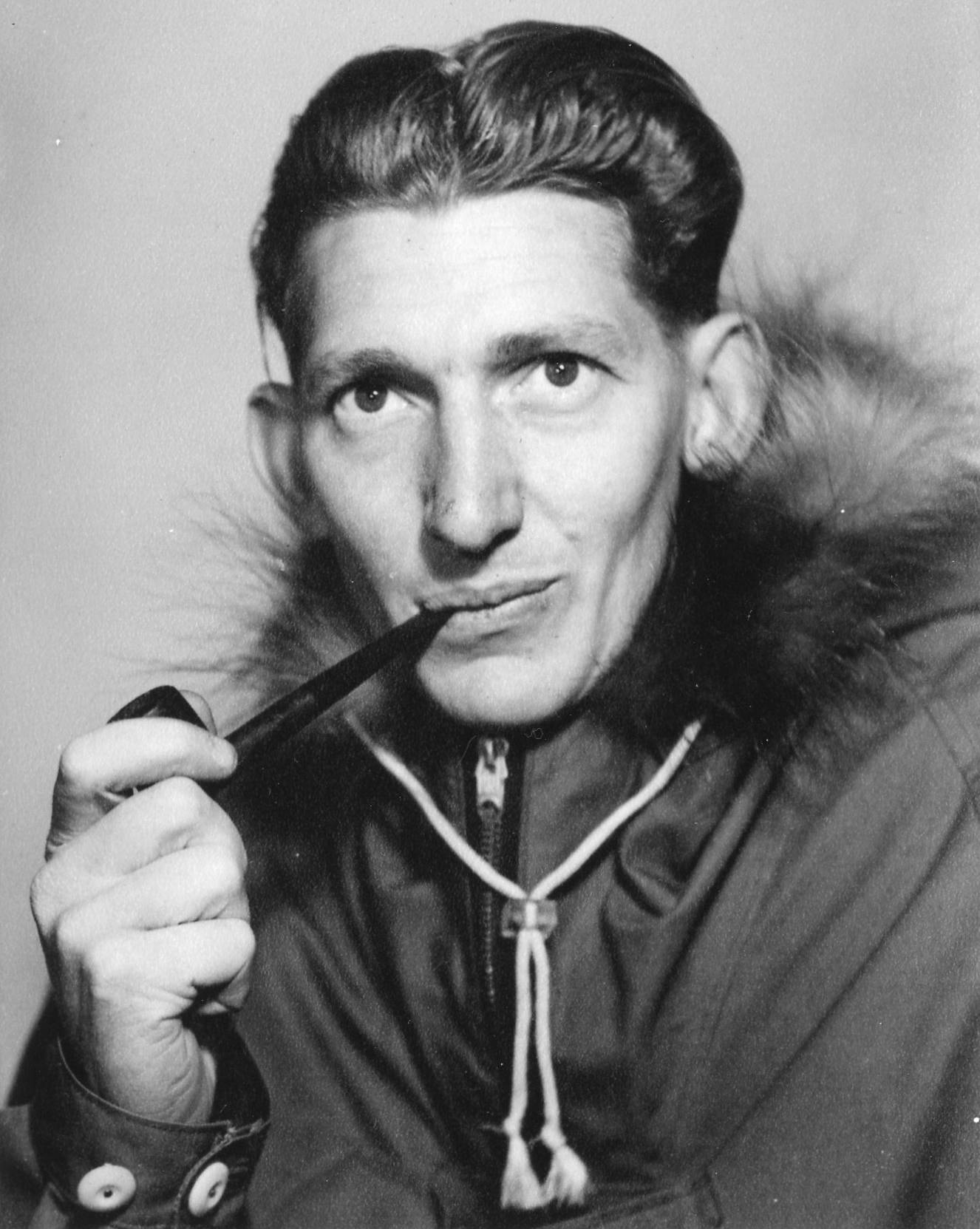
Ed in Antarctica in 1961.
Photo with thanks to Ed’s family.
|
After arriving in Adelaide from war-ravaged Germany, Ed von Renouard enrolled at the South Australian School of Mines for a part-time technician’s course and, in 1961, he went down to the Antarctic because “that was somewhere you couldn’t buy a ticket to”.
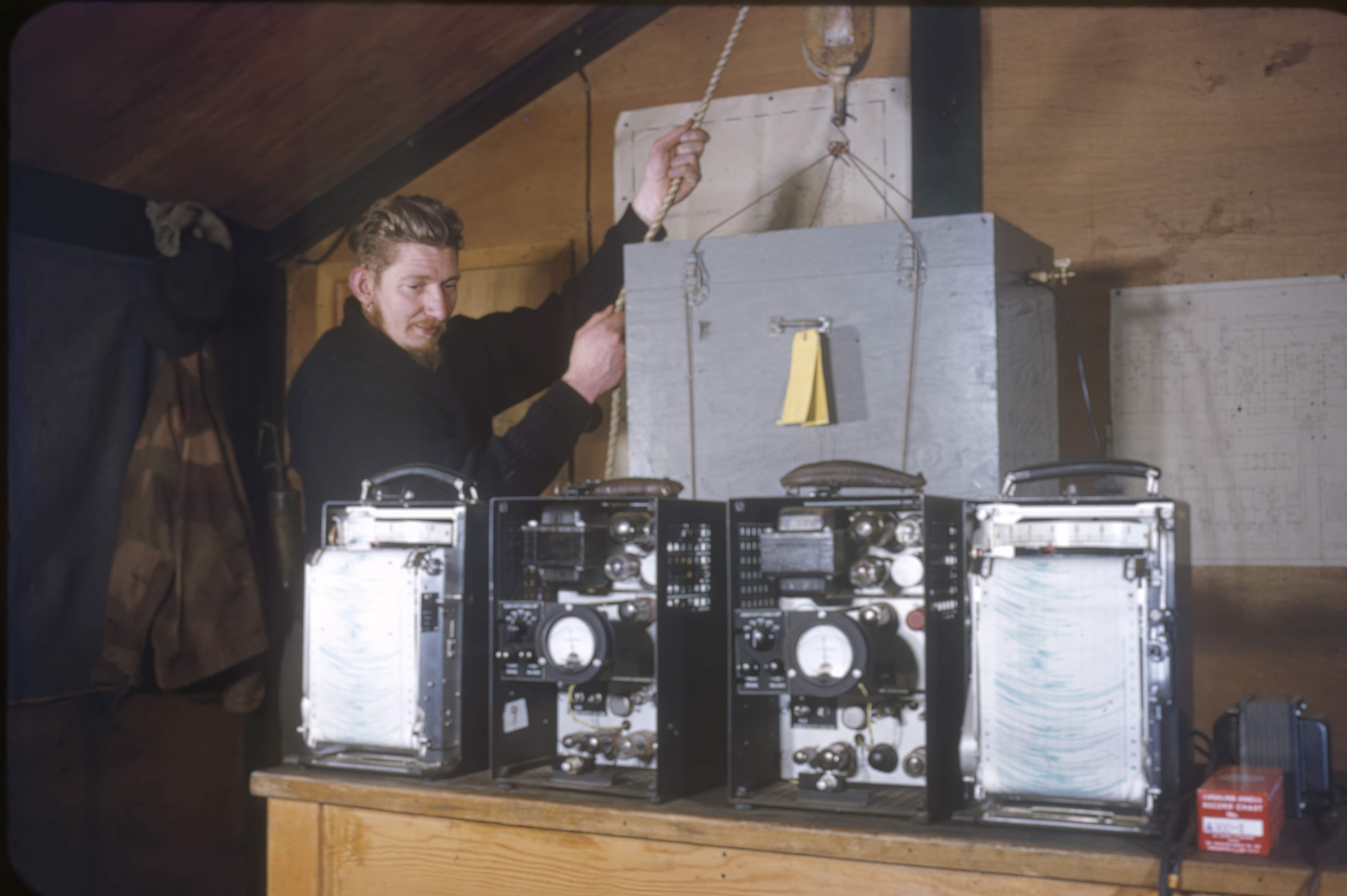
At Mawson Base, Ed spent a year as a radio technician performing meteorological observations, recording signals from radiosondes for relay back to Melbourne. He recalled his experience as “an enormous event” which, for him, was only equalled by Apollo.
|
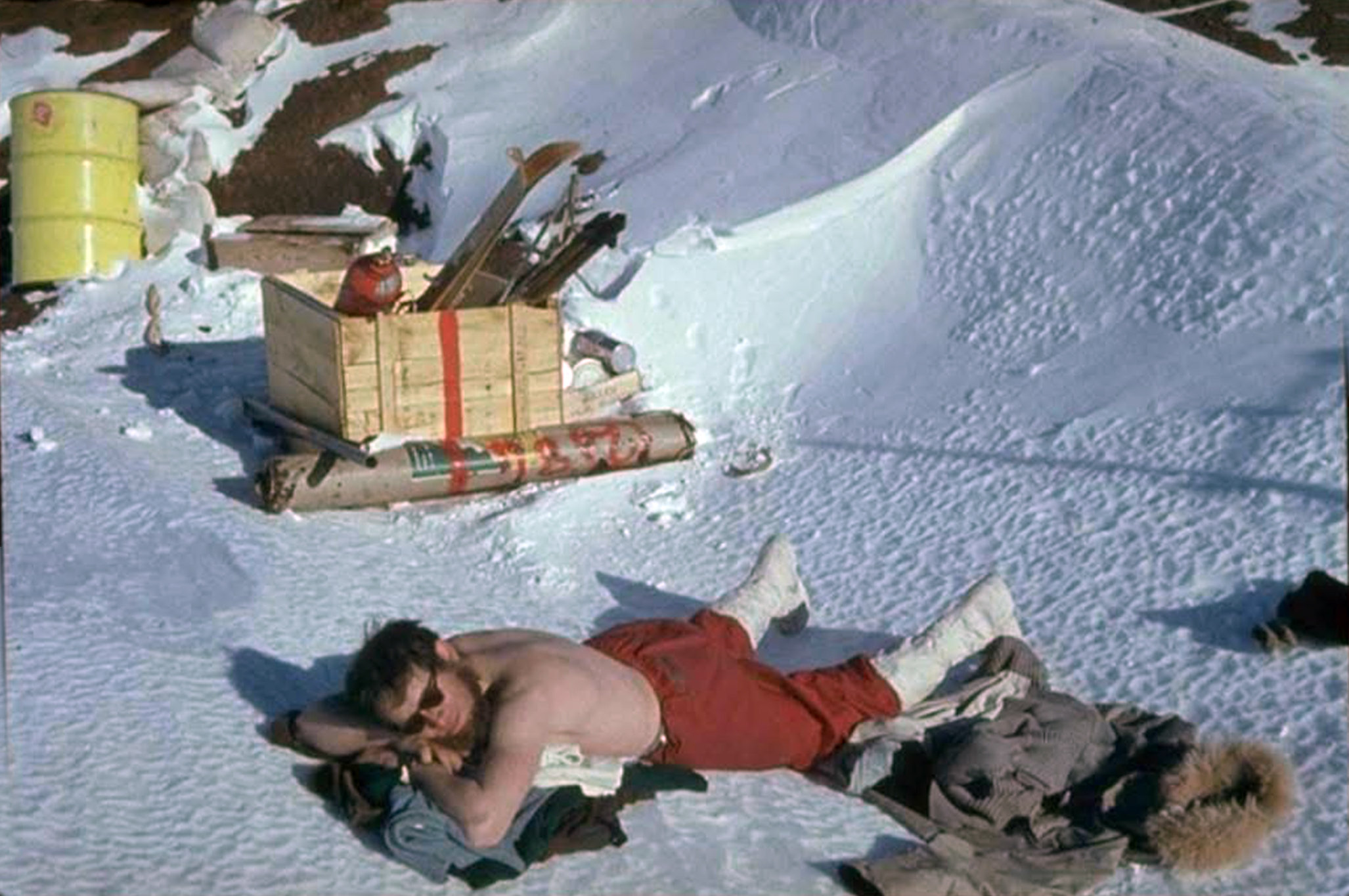
Ed catching some sun at Mawson Base.
Photo with thanks to Ed’s family.
|
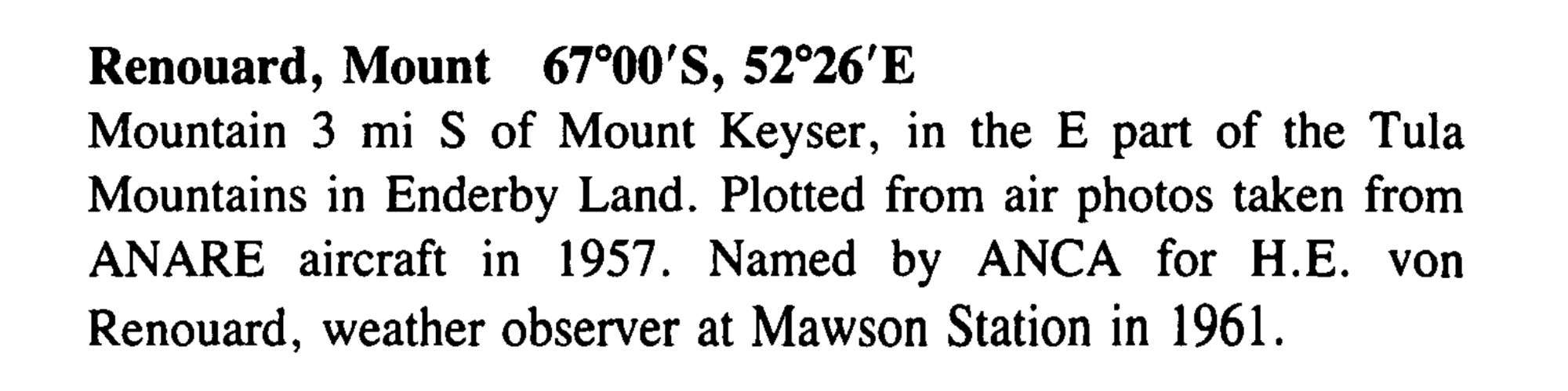
In recognition of his work in Antarctica, the Antarctic Names Committee of Australia named a mountain for Ed. Mount Renouard (67°00′S 52°26′E) is a mountain 5 km south of Mount Keyser, in the east part of the Tula Mountains in Enderby Land.
|
Mount Renouard entry from Geographic Names of the Antarctic.
|
Read more about Ed on this page.
|
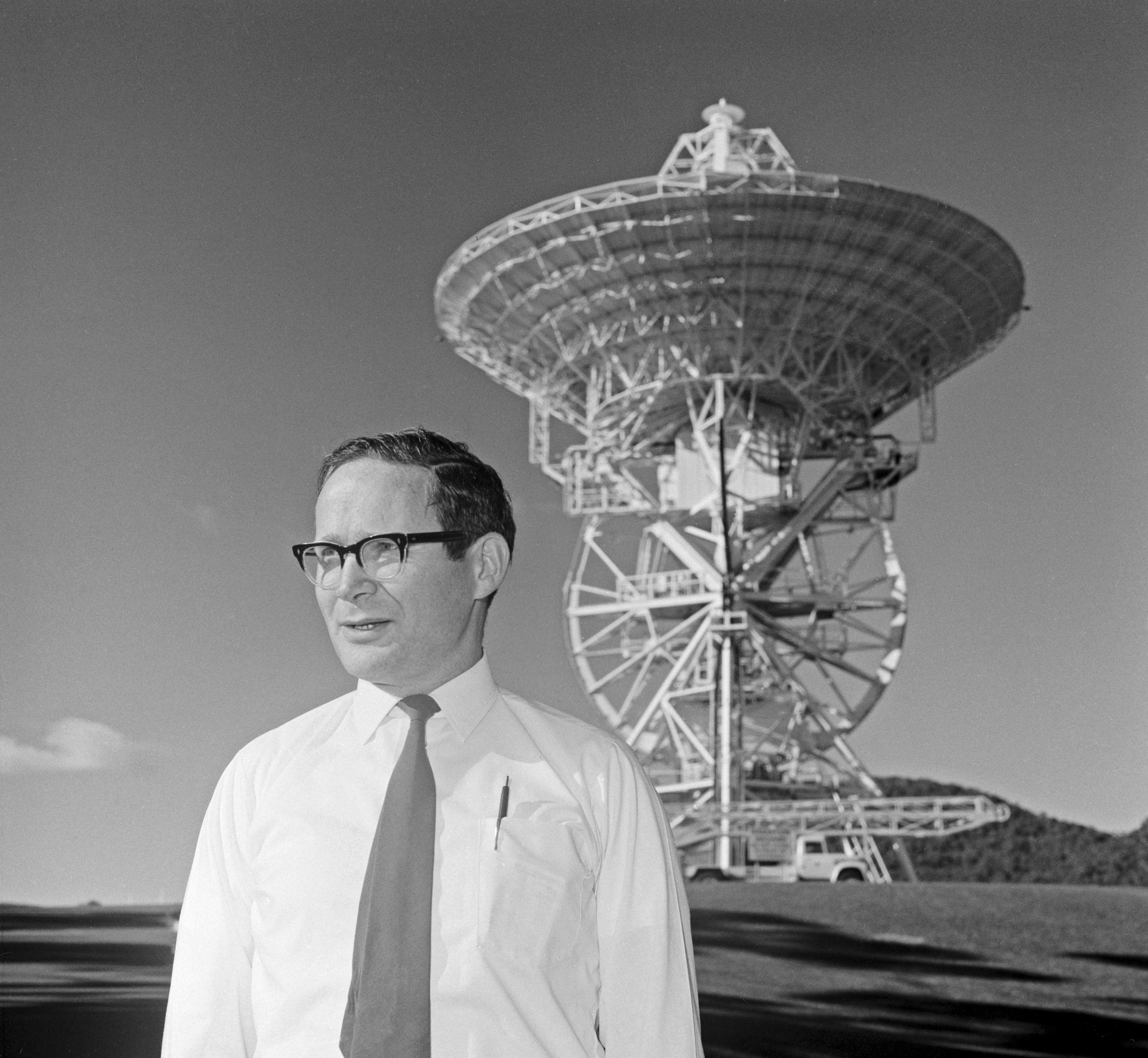
Ed von Renouard at Honeysuckle Creek in 1969.
Australian News and Information Service photo.
|
3.) Peter Trost.
|
Peter Trost at Macquarie Island in 1956.
Photo with thanks to Peter’s daughter Dalice.
|
Peter Trost served as cosmic ray physicist on Macquarie Island in 1956 and at Mawson Base on the Antarctic continent in 1958.
He returned to Mawson for 1962 where he was auroral physicist.
|
Peter Trost, dressed for Antarctic conditions.
Photo with thanks to Dalice Trost.
|
In early 1966, Peter joined the team at DSS41 Island Lagoon as Experimental Officer 3, Section Leader, Operations, working alongside Station Director Don Cocks, and was at the station for key missions including the Lunar Orbiters.
|
In this late 1968 photo of senior staff at DSS41 Island Lagoon, Peter Trost is third from right, wearing the white shirt.
|
He left Island Lagoon in late 1968 to become the Engineer with the Department of Supply’s American Projects Branch. He was responsible for ground communications – i.e. the Australian sector of NASCOM – NASA’s worldwide communications network.
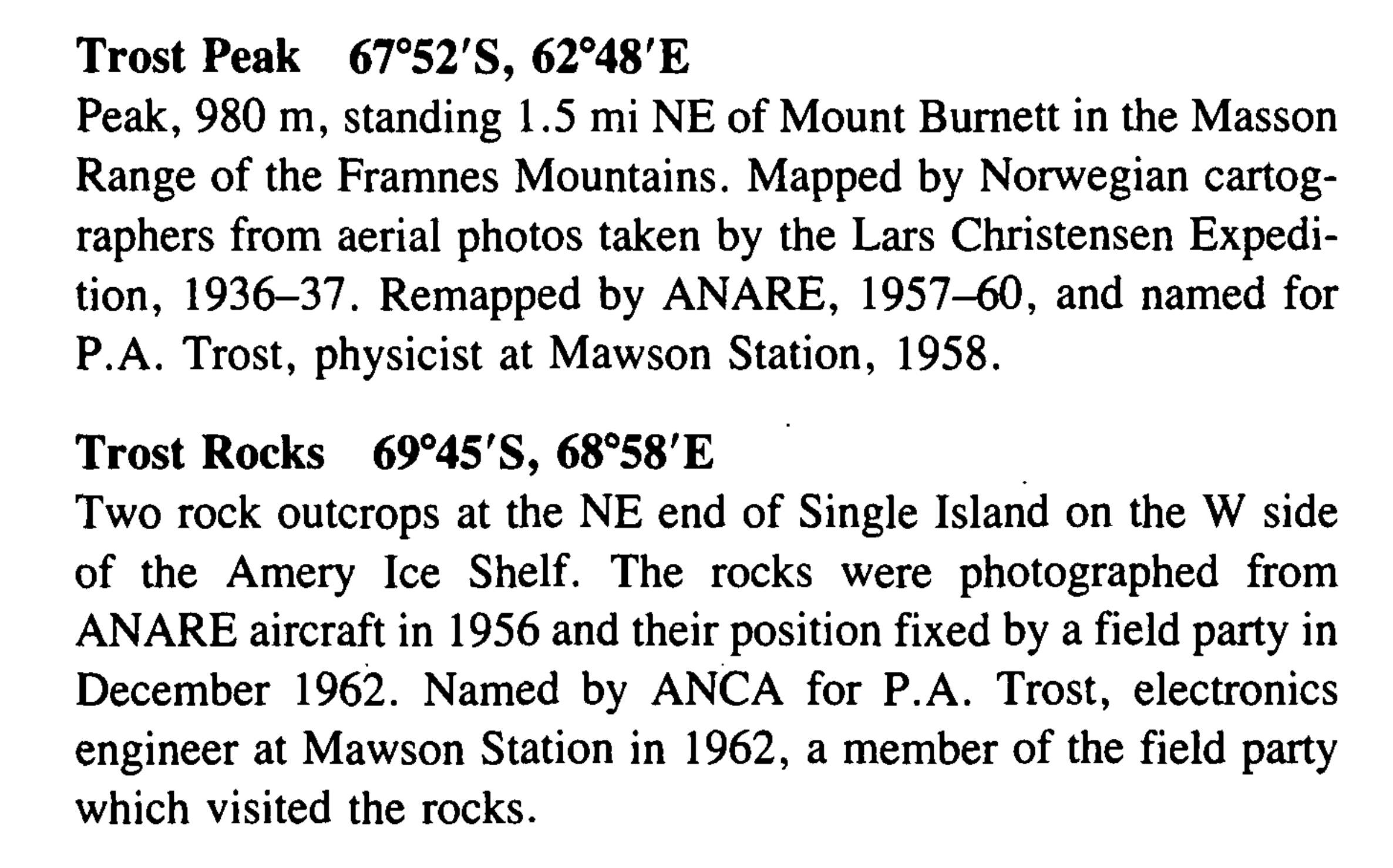
Two geographical features in Antarctica are named for Peter – Trost Peak and Trost Rocks. Peter was in the party which sighted Trost Rocks from the Amery Ice Shelf in 1962. He visited the feature, 90 metres above the ice shelf and assisted in the astrofix.
|
Trost Peak and Trost Rocks entries from Geographic Names of the Antarctic.
|
4. Keith Brockelsby
|
Keith Brockelsby in Artarctica, 1961. Photo: Brockelsby family.
|
Tidbinbilla’s Keith Brockelsby obtained his Bachelor of Electrical Engineering from the University of Auckland in 1954. Also while at university he met Lynette and they were married in Hastings in 1954.
After a stint with the NZ Civil Aviation Administration, and then the New Plymouth City Electricity Department, in 1958 Keith was offered a position at Salisbury, South Australia. This work involved development and testing of the Seaslug surface-to-air missile at Woomera.
|
Keith Brockelsby on the ice, 1961. Photo: Brockelsby family.
|
In 1961-62, Keith spent a year at Mawson Base in the Antractic as an Ionospheric Physicist with the Australian Antarctic Research Expedition.
After that service, he was honoured by having an Antarctic mountain – Mount Brockelsby in the Scott Mountains – named for him.
|
Keith Brockelsby at Mawson, 1961. Photo: Brockelsby family.
|
|
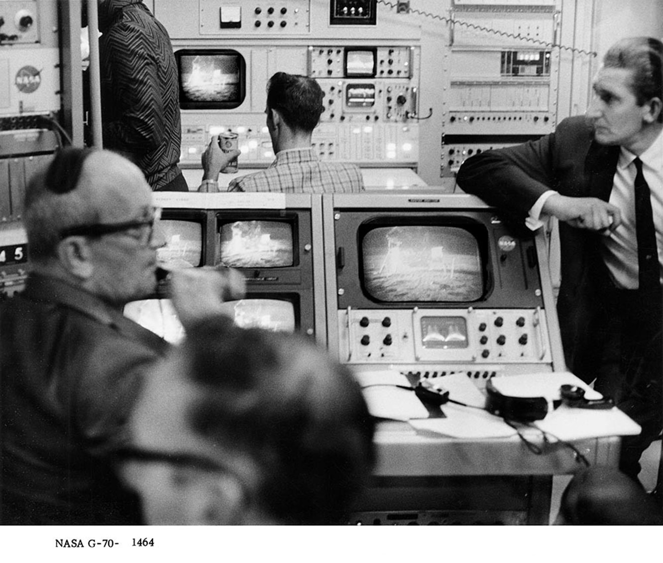
Keith, Chief Electronics Engineer at Tidbinbilla c. 1968.
|


Base_1956-7.jpg)