Orroral Valley Construction


Construction, 1964-65


Bob Leslie writes,

“The Orroral Valley site for a tracking station to support earth orbiting satellites, as part of NASA’s Spacecraft Tracking and Data Acquisition Network (STADAN), was selected in late 1963.

The land was acquired from Mr Greenfield in April 1964 as notified in the Commonwealth Gazette No. 9 of 30 April 1964. An area of about 40 acres was fenced for the use of the station and the remainder of the land was returned to Mr Greenfield for agistment.

The contract for the construction of the station buildings, power house, antenna foundations, etc., was let by the Department of Works to T. H. O’Connor in August 1964.”


Orroral Valley

Left to right: Ernie McLean; Tommy (T.H.) O’Connor, building contractor; Mr. E. (Eric?) Greenfield, whose land was acquired for the station.

This photo was taken at Orroral Valley, near the Coll. tower track, in October 1964.

T. H. O’Connor Pty. Ltd was involved with the construction of Tidbinbilla, Orroral Valley, and Honeysuckle Creek Tracking Stations (and many Canberra buildings).

Photo from the Tidbinbilla archives. Scan: Colin Mackellar.


Getting materials into Orroral Valley wasn’t an easy task. The terrain was rugged, and roads had to be created.


Orroral Valley

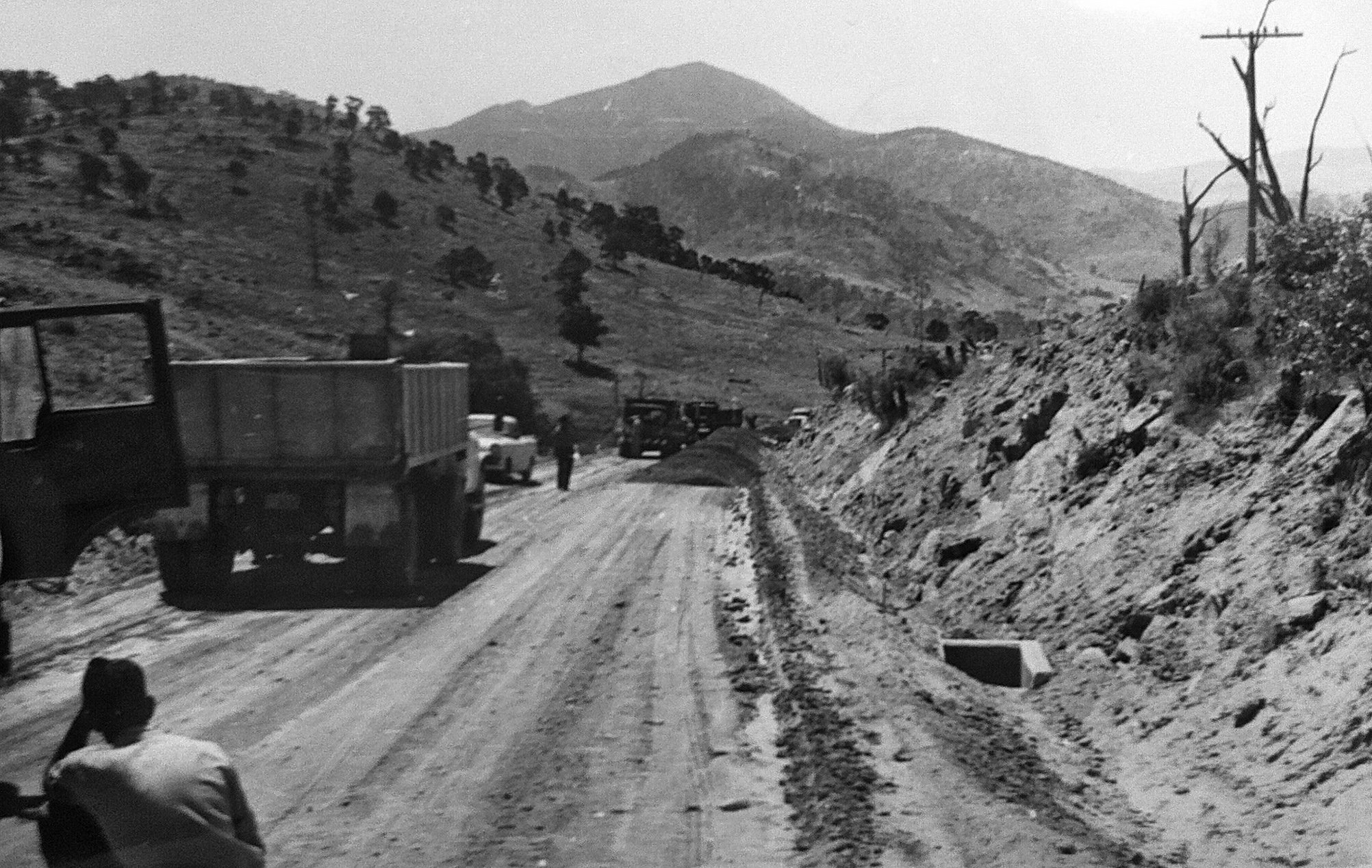
This photo from the Tidbinbilla archives shows DAF (Data Acquisition Facility – i.e. Orroral Valley) roadworks, 2nd March 1965.


Photo series from Richard Collins:

Richard Collins, Department of Supply, writes, “I took these while I accompanied the heavy transport team as they took building materials into the Orroral Valley. One of the slopes required two prime movers in tandem to move one load and this was after some dynamiting some of the rocky obstacles in the track.”

The photos of parts for the 26 metre antenna being transported to the site are probably from late 1964.


Orroral Valley

A.


Orroral Valley

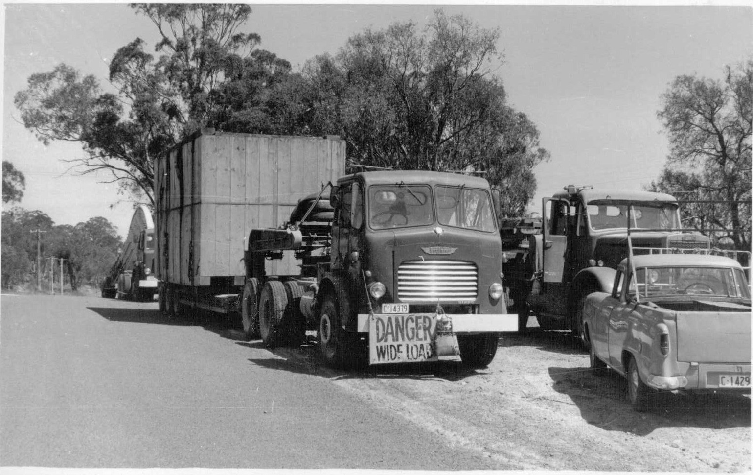
B. Crossing the Tharwa Bridge.


Orroral Valley

C. Crossing the Tharwa Bridge.


Orroral Valley

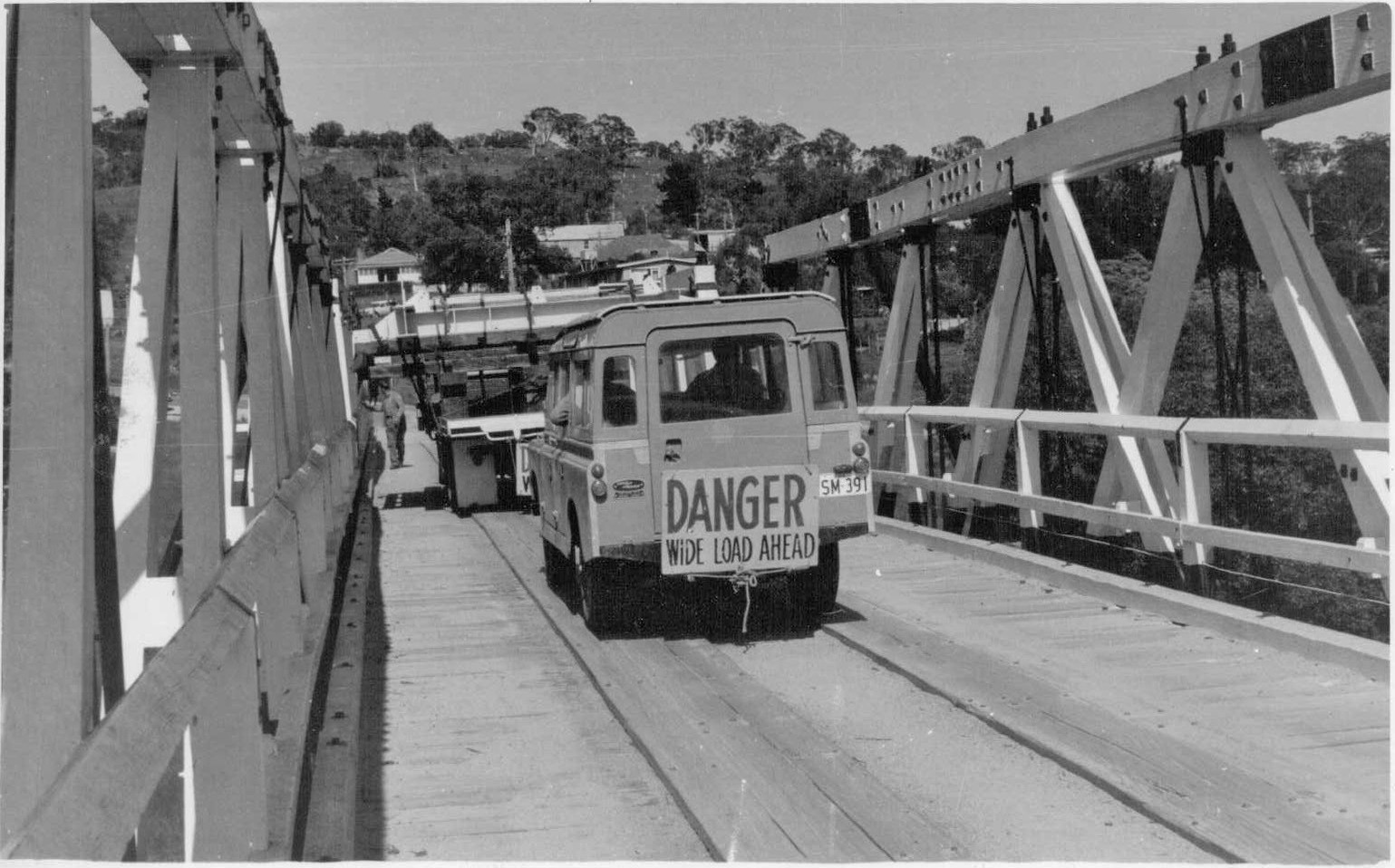
D. Crossing the Tharwa Bridge, with only a little clearance on either side.


Orroral Valley

E. Just across the western side of the bridge, in Tharwa.
Continue on Naas Road towards Orroral, or turn right to Tidbinbilla.


Orroral Valley

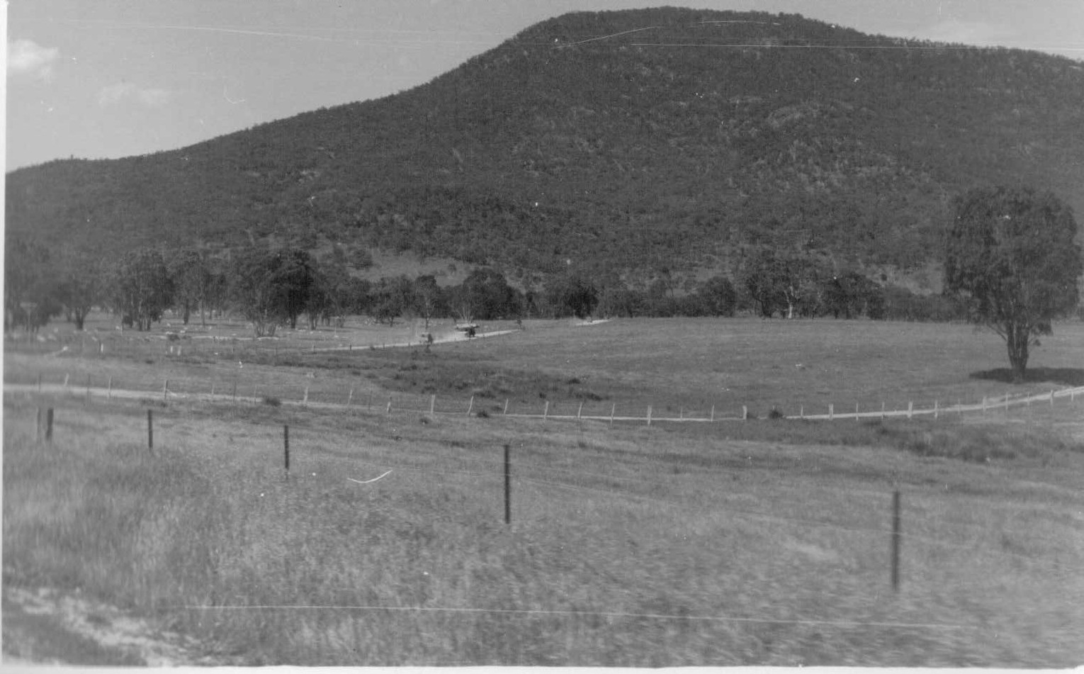
F. Heading towards Orroral.


Orroral Valley

H. Dick writes that this is
“Tiger Roach, the chief ganger, with his team.”


Orroral Valley

I. “Tiger again, with his senior driver I knew only as ‘Dubbo’, presumably where he was born.”


Orroral Valley

J.


Orroral Valley

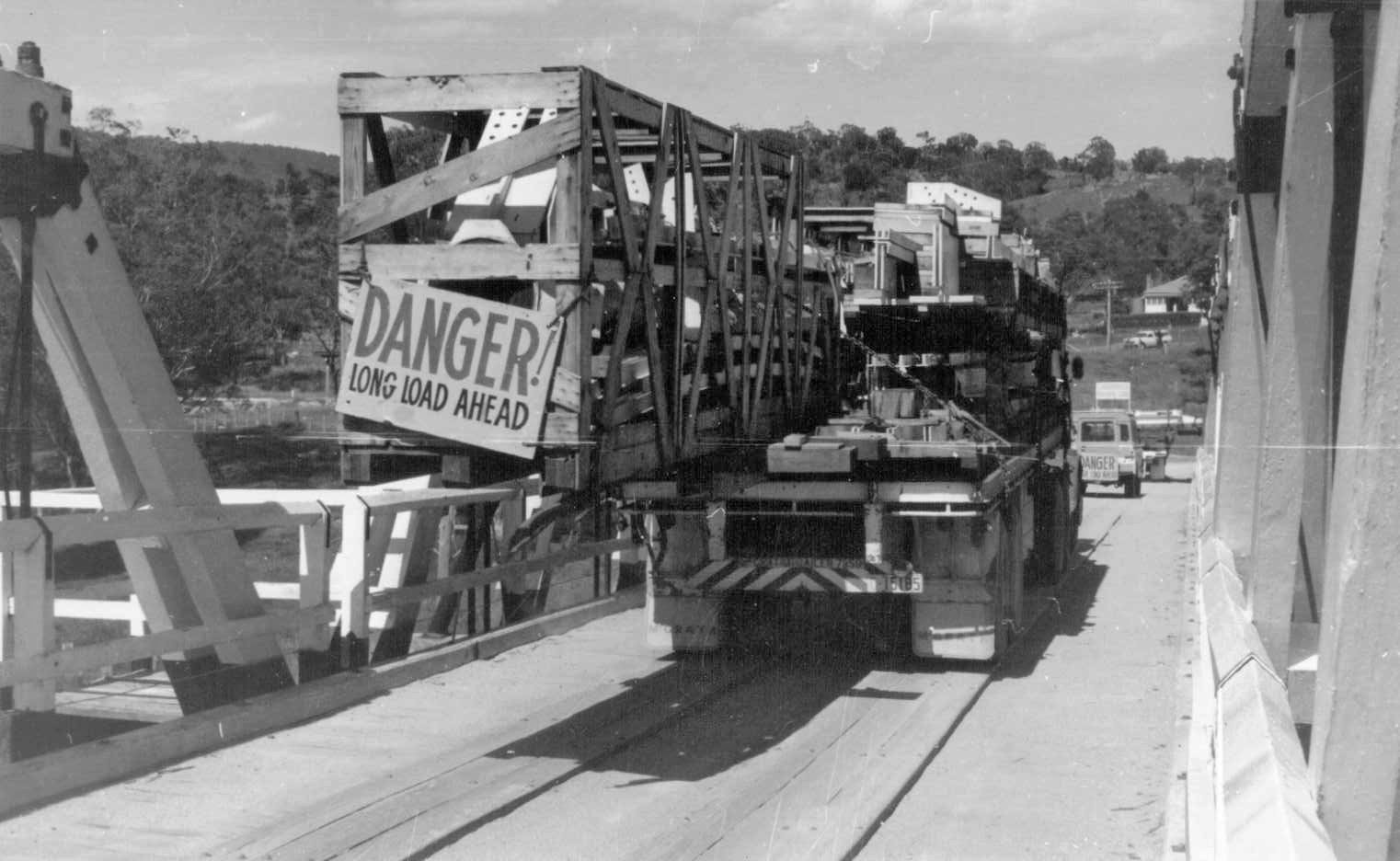
K. Philip Clark writes that this is “Rocky Crossing on the Gudgenby River. I believe that this crossing had to be constructed in order to get the antenna components to the site.”


Orroral Valley

L.


Orroral Valley

M. “A second prime mover assisted the leading one by pushing.”


Orroral Valley

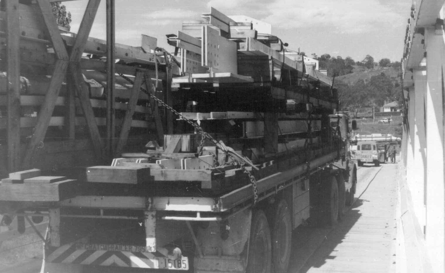
N. Antenna components on site.

With thanks to Dick Collins for the above photos.


Orroral Valley

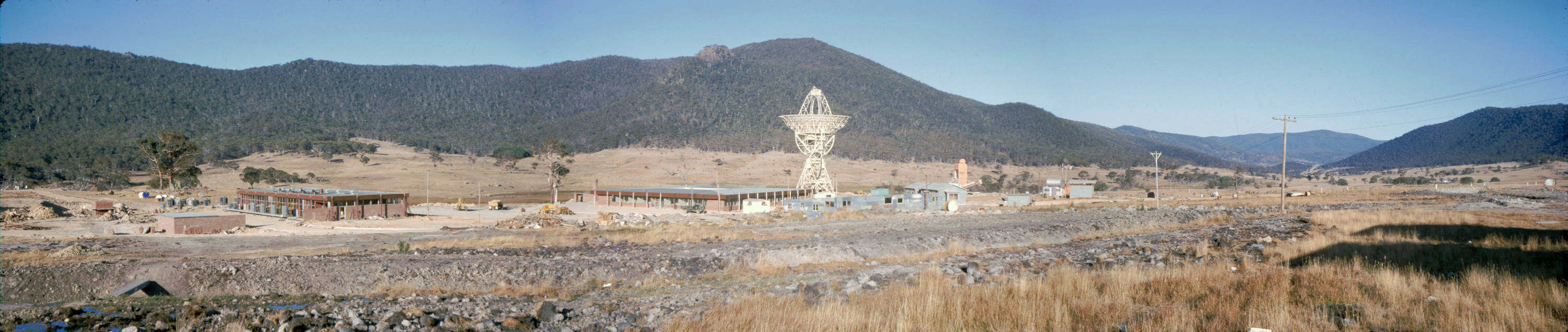
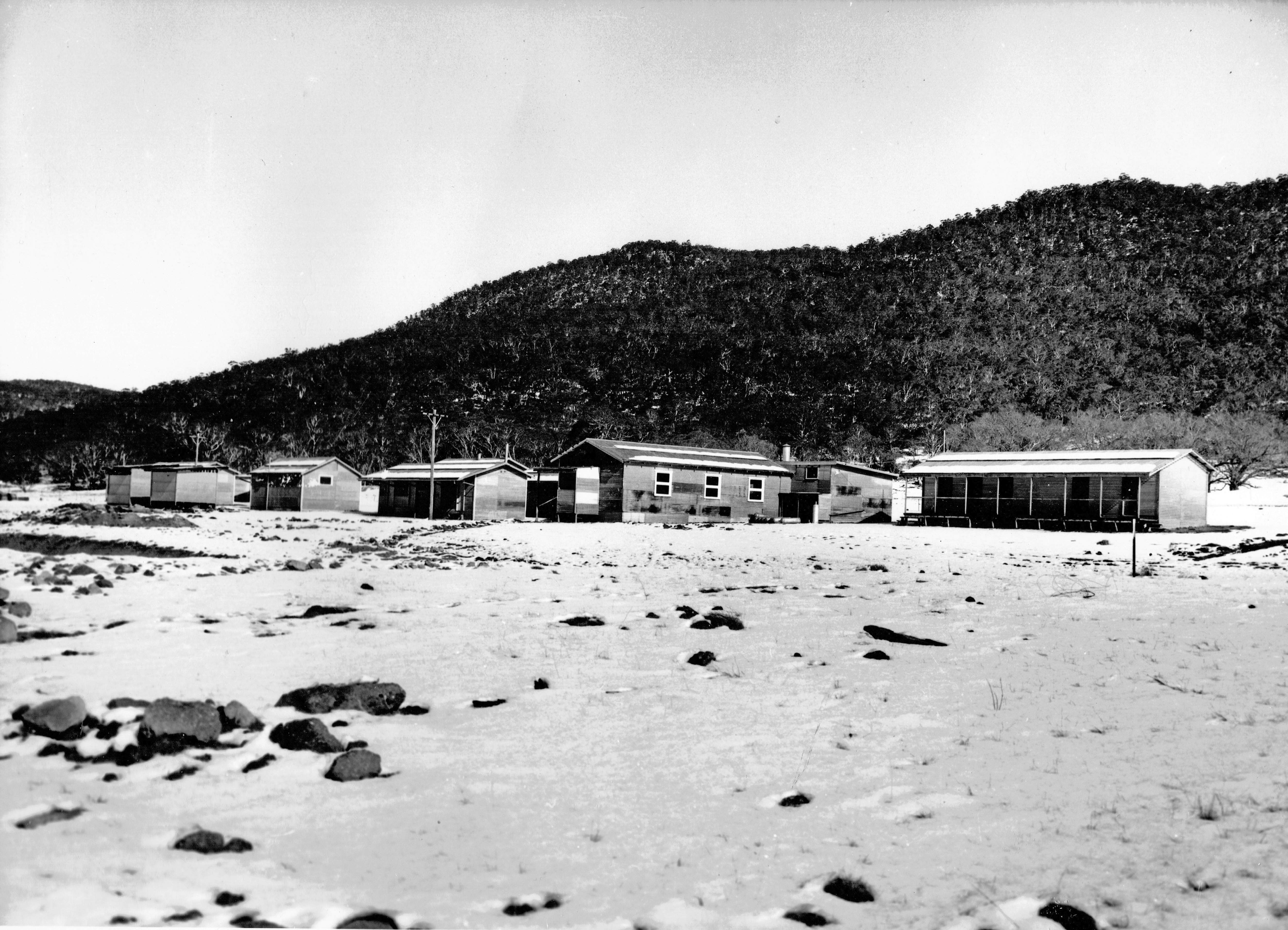
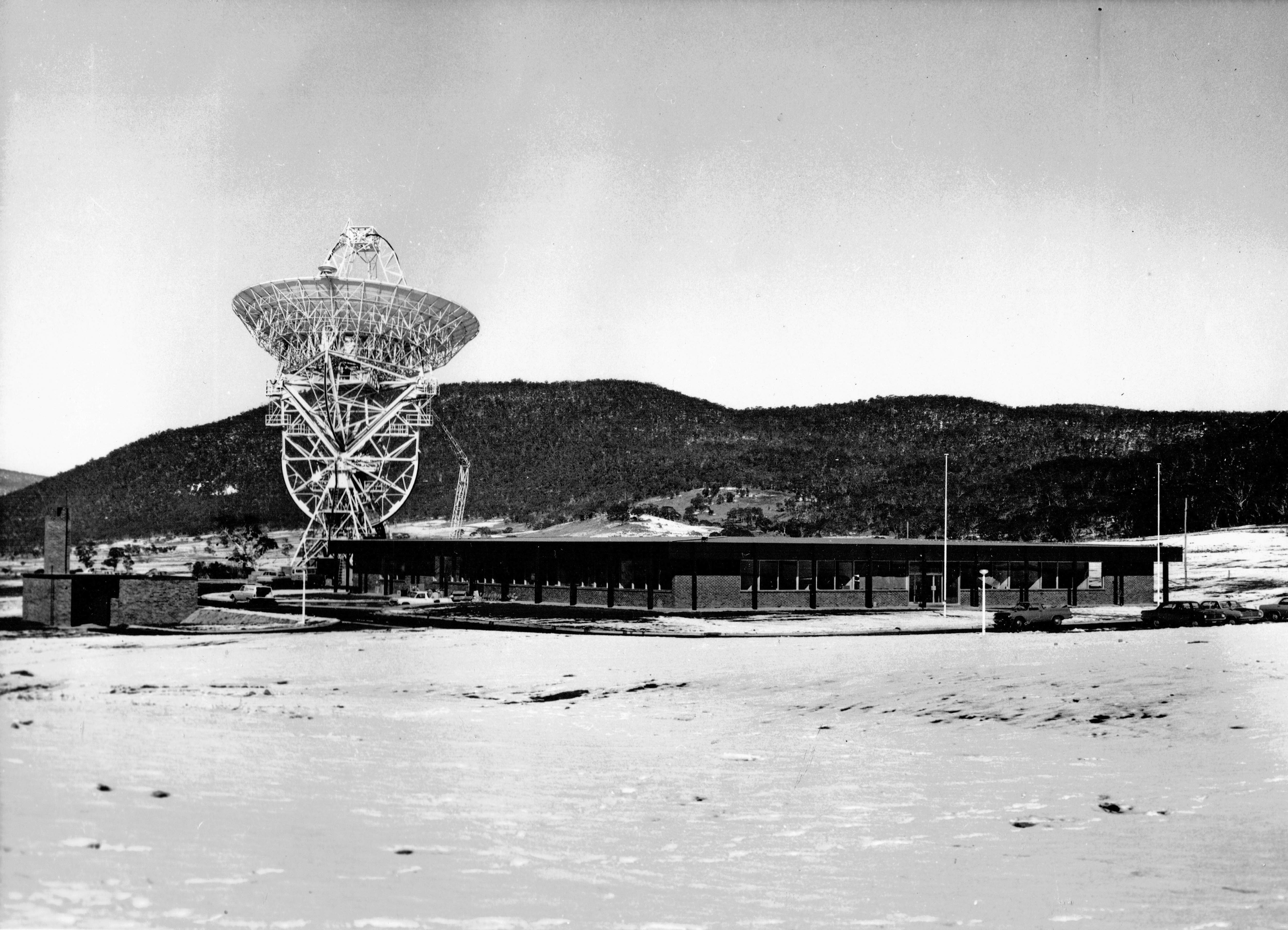
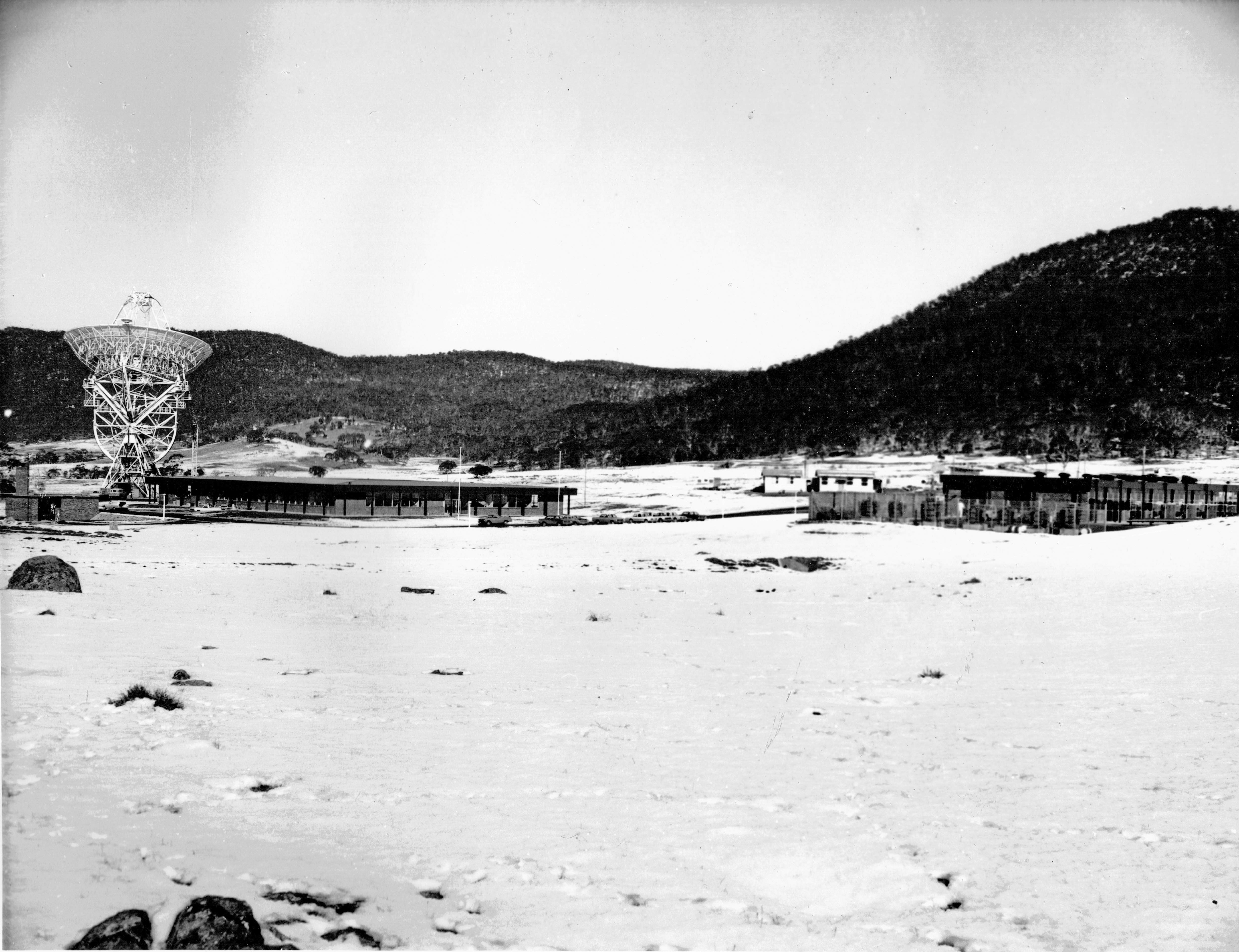
Orroral Valley Panorama, circa May 1965.

Large, Full resolution.

Andy Kenner, an Electrical Tradesman with Rex Barrett Electrical in Canberra, was involved in the initial electrical work at the station. Andy took these transparencies around May 1965.

His daughter Jenelle says he was likely “involved in establishing initial power to the building and surrounds, and basic lighting and power.

Apparently they worked 6 days a week out there, coming back to Canberra on Saturday evenings and returning to Orroral Valley on Sunday nights. … The only part of the road that was sealed at the time was a steep hill section, and apparently that is the only section of the road that my Dad ‘came off’ in his much loved FC Holden! Both the car and driver lived to tell the tale and continue on to their destination.”

The panorama above covers the Powerhouse at left, the Operations Building, and the 85 foot (26 meter) dish at centre.

Visible are the workers’ huts, offices and workshops, with the cement plant in the background. The road enters from the right.

With special thanks to Jenelle Kenner for the scans.

Panaorama assembled by Colin Mackellar from these three images.


Orroral Valley

Two unidentified colleagues. (Can you name them? Contact.)
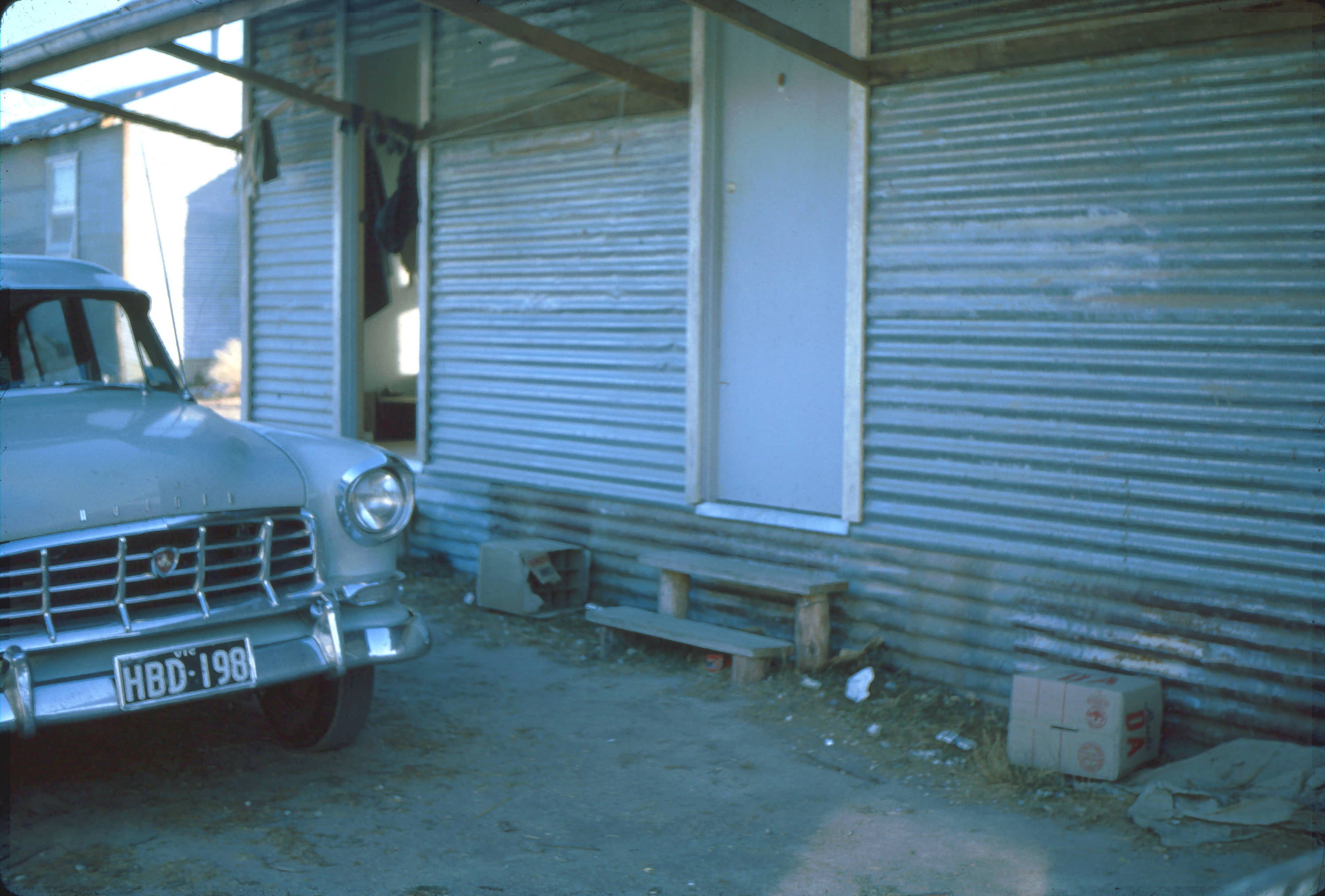
Photo: Andy Kenner.


Orroral Valley

The entrance to one of the the on-site huts.

It’s possible that these huts are the ones which were installed at Honeysuckle Creek the next year.

Photo: Andy Kenner.


Orroral Valley

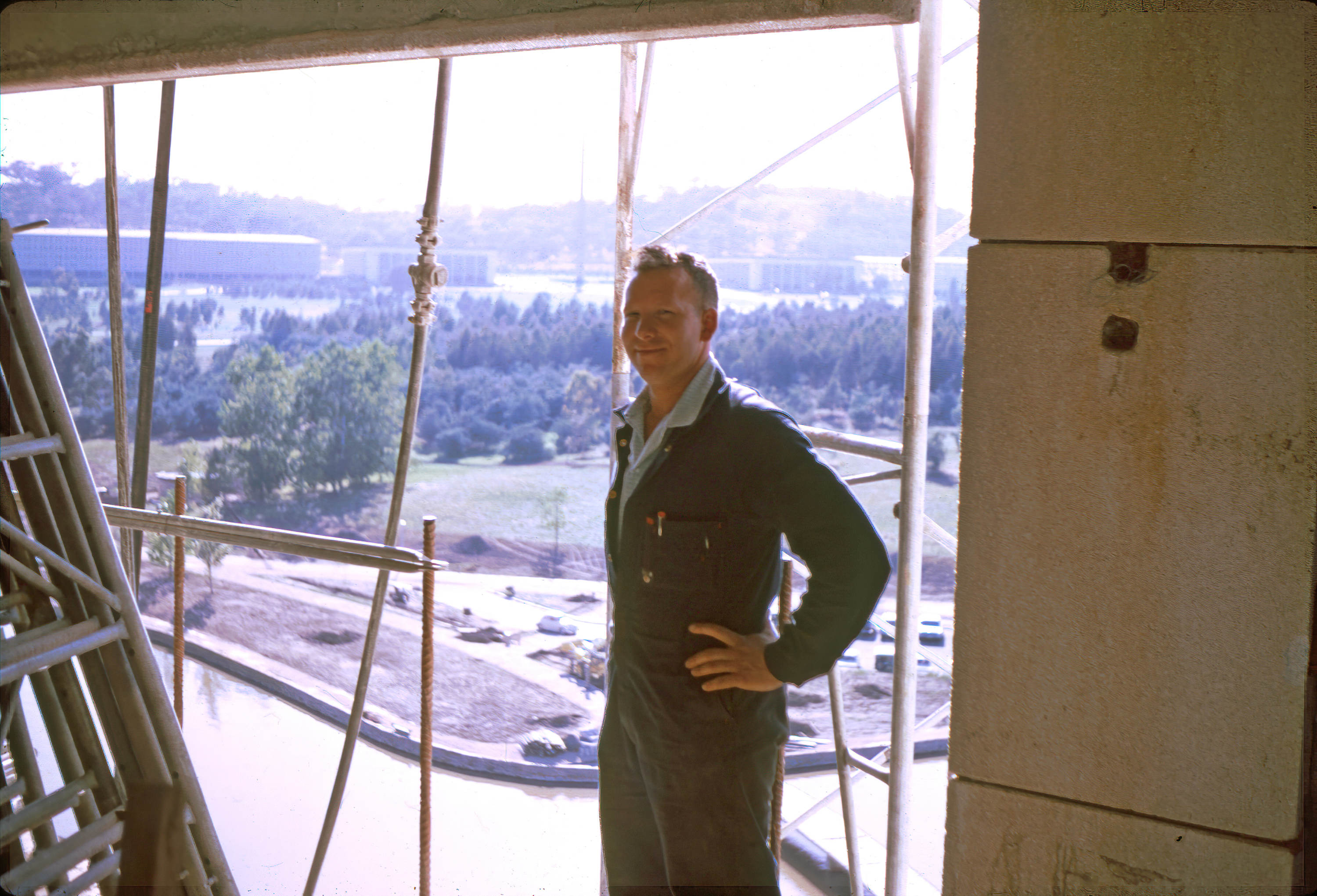
Andy Kenner and his colleagues worked on a number of projects around Canberra, including the National Carillon on Aspen Island in Lake Burley Griffin.

This view from the Carillon (which was opened by Queen Elizabeth II in 1970) looks across to the Defence offices in Russell.

Photo courtesy Jenelle Kenner.

New

Orroral Valley

On-site accommodation used by T.H. O’Connor staff engaged in the construction of the buildings at Orroral Valley. Some time in 1965.

This, and the two photographs below, were preserved by Roger Kirchner who was a member of T.H. O’Connor’s staff.

Honeysuckle’s Geoff Seymour writes, “Although he was a carpenter by trade, he was heavily involved in estimating construction costs for Orroral Valley and Honeysuckle. He eventually set up his own building business constructing Canberra homes.”

With thanks to Judy Kirchner.

Scans and information by Geoff Seymour.


Orroral Valley

The Orroral Valley 85 foot (26 metre) antenna, cherrypicker and Operations Building under snow.

Scan by Geoff Seymour.


Orroral Valley

The Orroral Valley 85 foot (26 metre) antenna, and Operations Building under snow. The powerhouse is at right.

Scan by Geoff Seymour.