Over time, two unrelated laser ranging stations were installed at Orroral Valley. One near the Minitrack site for tracking satellites, and another for geodetic work.
In June 2010, Orroral’s Philip Clark responded to a question about laser-ranging from Orroral Valley. Philip wrote:
“You mention ‘A Laser-ranging Geodetic Observatory was also installed, for the purpose of ranging on the laser reflectors left on the lunar surface by the Apollo astronauts.’
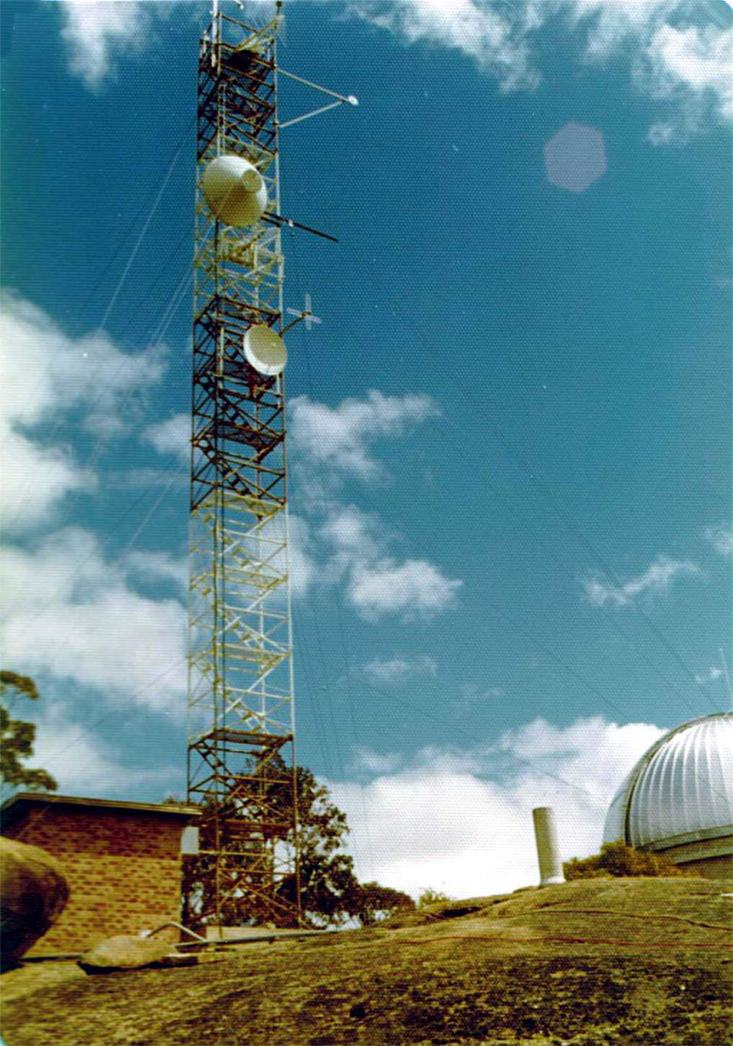
This was the laser installed and originally operated by the Australian Department of National Mapping. It was located on Mt. Orroral near the 26M antenna colimation tower.
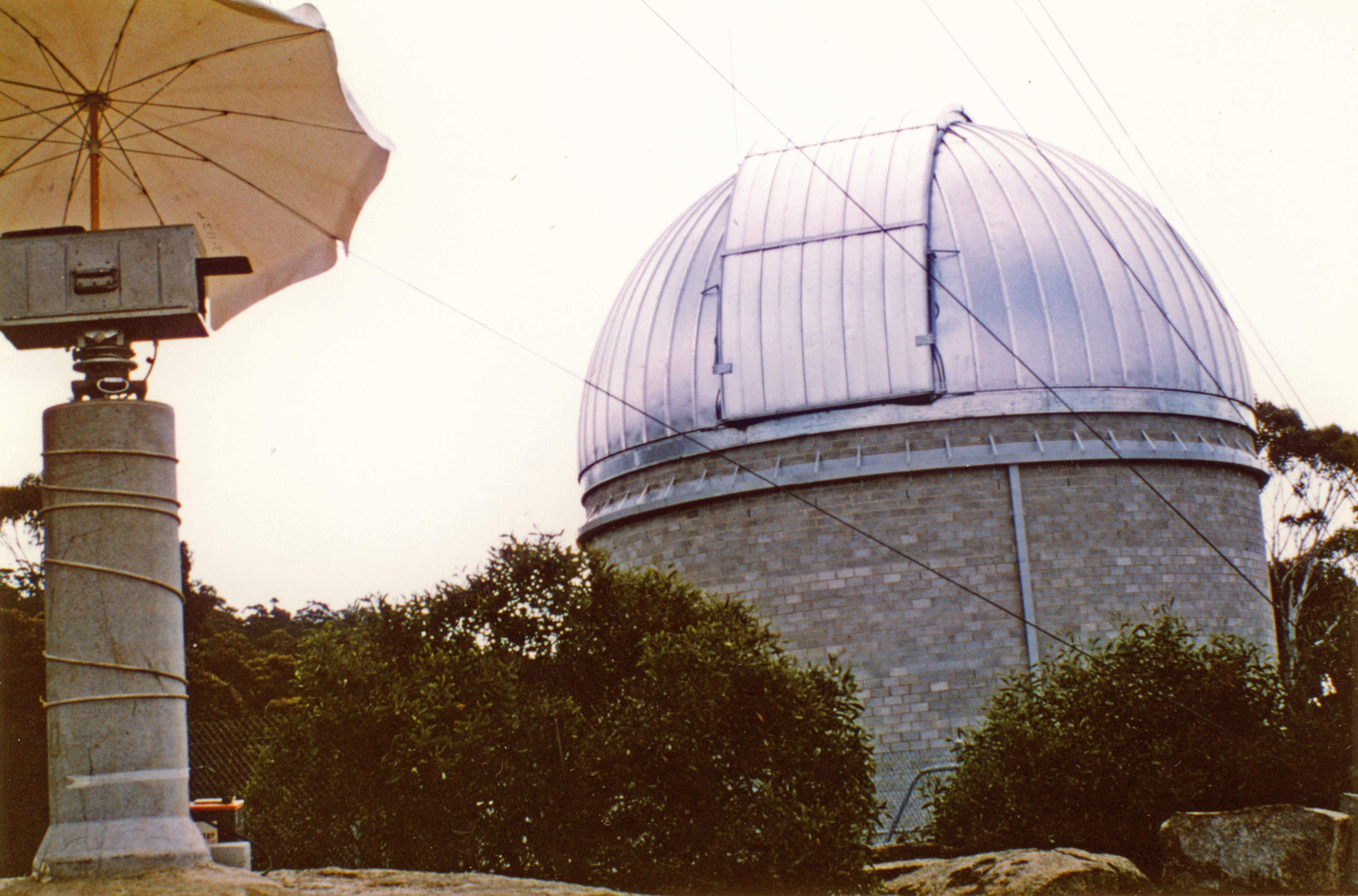
Orroral also had another laser system installed somewhat earlier under the auspices of the Smithsonian Astrophysical Observatory (SAO) of Cambridge, Massachusetts.
|
The earlier laser system installed near the Minitrack site. 1983 photo: Philip Clark. |
This laser could track satellites fitted with retro-reflectors out to about 10,000 or 12,000km. I was the supervisor of this system for a number of years. The calibration target for this laser was a white roughly painted board fixed to a rock just below the colimation tower. The reflections from this board with about a 3Km round trip were so powerful that the laser receiver needed 80db to 100db of attenuation so as not to saturate.”
This page is about the National Mapping Orroral Valley Laser Ranging System –
In June 2010, Col Cochran (Cooby Creek, Honeysuckle Creek, Orroral Valley) kindly wrote these very helpful notes for this website–
The National Mapping Orroral Valley Laser Ranging System
|
Col Cochran at Honeysuckle Creek – in the post-Apollo-11 team photo by Hamish Lindsay. |
The Orroral Laser Ranging Geodetic Observatory was built in 1974 after the successful negotiations between the Australian Division of National Mapping, Positional Astronomy group and the Smithsonian Institution in the United States of America for the loan of an astronomical telescope, initially for lunar laser ranging to the retro reflectors left on the lunar surface by the astronauts of Apollos 11, 12, 14, 15, and 17.
|
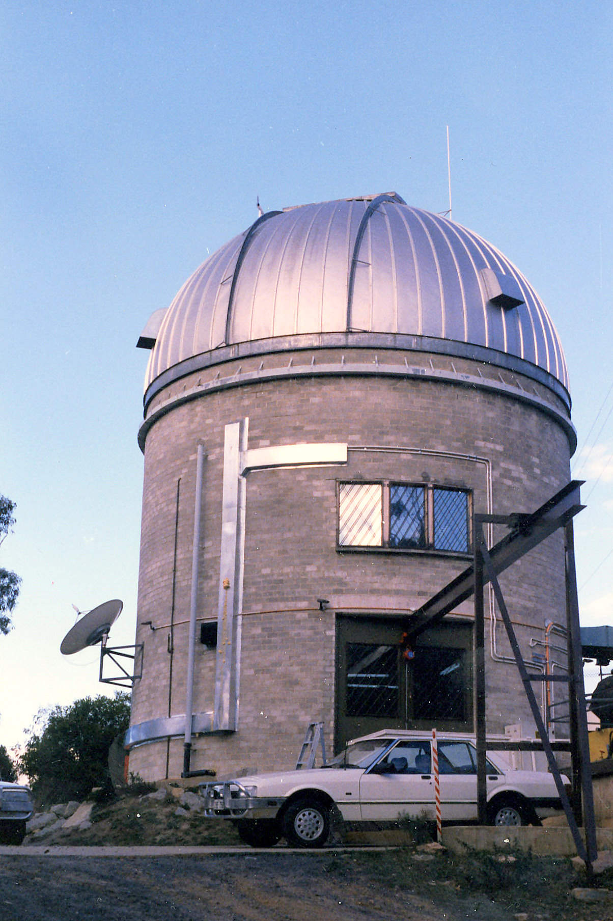
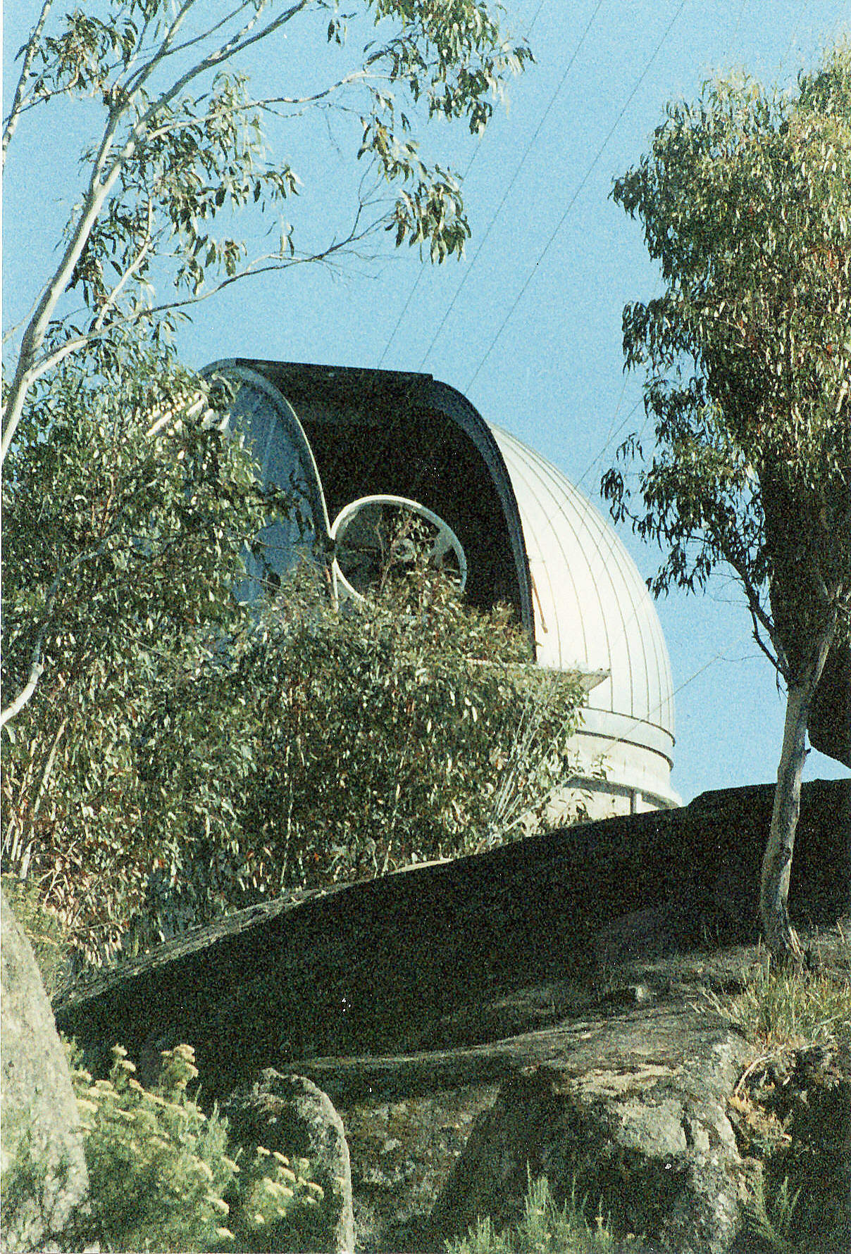
The Laser Ranging Observatory on Mt. Orroral.
Undated photo via Philip Clark. Scan by Colin Mackellar. |
Prior to the establishment of the observatory the Positional Astronomy group was charged with the maintenance of the Australian Frequency Standard. The frequency standard was derived from an ensemble of atomic clocks, each compared with all others members of the ensemble producing a corrected time scale and globally connected every six months or so by a travelling NASA atomic clock. In addition, positional astronomy had its own atomic clock that travelled to various agencies within Australia referencing each to the International Time Standards AT, UTC, UTC1 etc. via the Australian time standard. The ensemble was initially housed at Mount Stromlo together with a Photographic Zenith Tube telescope, but was transferred to the Orroral Observatory later.
The Smithsonian telescope was an F/8, 1.5 metre primary mirror Ritchie Chretien design having a moderately wide field of view ~ 0.7 degrees. The telescope mount was an Hour Angle, Declination design primarily for tracking sidereal star systems. The problem with this type of design, although very good for star and lunar tracking, was that it had a considerable keyhole around the southern celestial pole. A keyhole is an area that cannot be accessed by the telescope because of its own mechanical structure. Later, when the system was upgraded to satellite tracking, this limitation was a major disadvantage as many satellite orbits tracked through this zone.
The observatory was built by a local contractor, unfortunately in the middle of winter, and often they were unable to get their materials up to the site, a trip of some four kilometres and exactly one thousand feet higher than the valley floor. The snow line was approximately half way up. The positional astronomy group had several four-wheel drives and standard Ford Falcon cars at that time, which were used to ferry the materials up to the site.
|
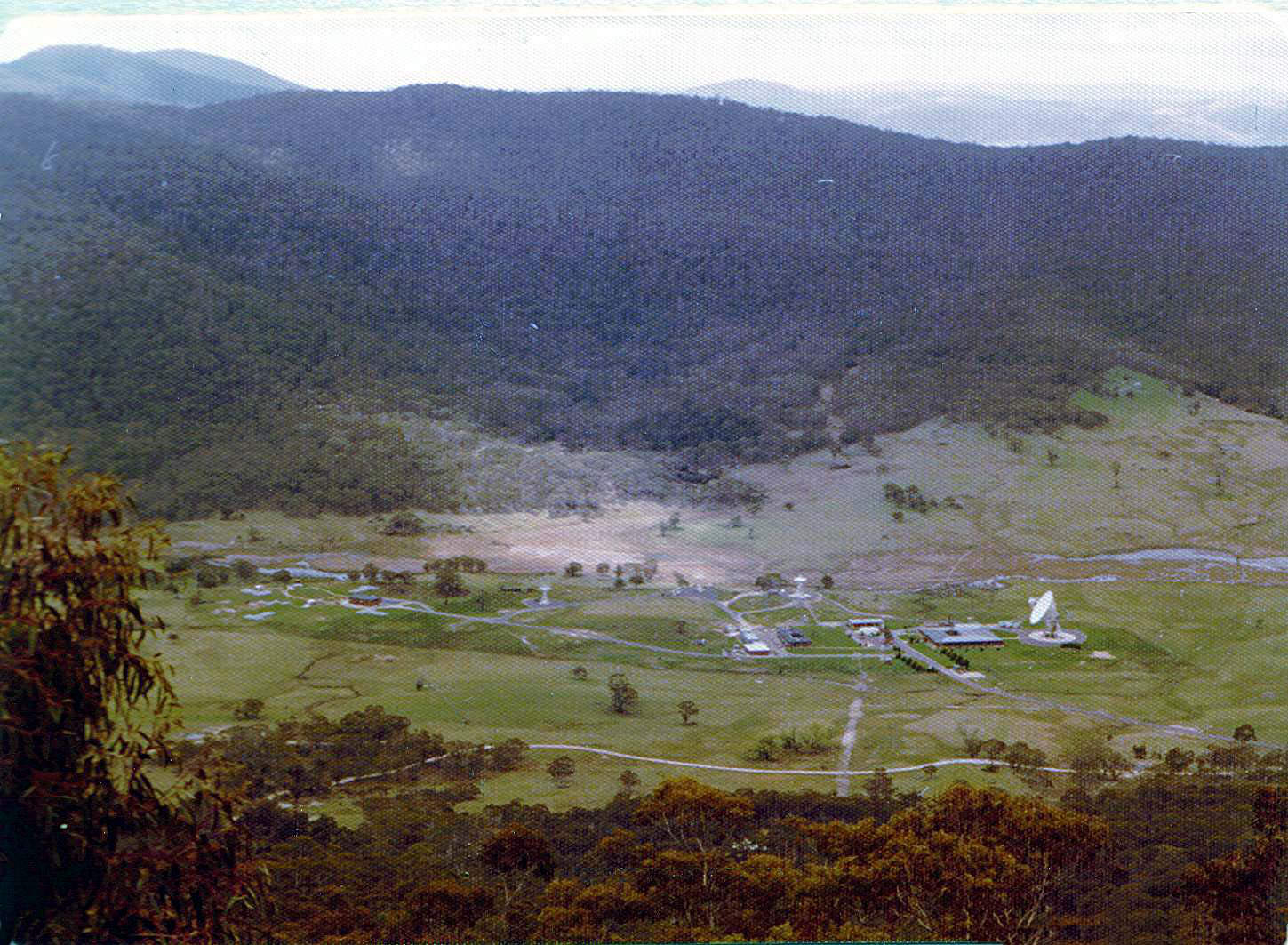
The Laser Ranging Observatory was set up high above the valley on Mount Orroral, adjacent to the Collimation Tower.
Photo: Philip Clark. |
|
The view of Orroral Valley from the Coll Tower.
Photo: Philip Clark. |
|
The Laser Observatory.
Photo: Col Cochran. |
After the observatory was completed, the telescope was set onto its own mount, totally isolated from the building and then aligned to the Southern Celestial Pole. This allowed the telescope to track lunar features in hour angle with only very small corrective movements of the Dec. axis.
The transmit / receive system was assembled on a large optical table bolted to the declination cube of the telescope illuminating the telescope by a dichroic tertiary mirror which allowed the direct viewing at the RC focus.
The transmitter was a Q switched 6943 Angstrom ruby laser with an effective power of some 0.5 Gwatts and a pulse length of ~ 30 nsecs firing every 5 seconds.
The detector was a fast 28% quantum efficiency photo multiplier tube driving the processing electronics. It was possible to detect one out of every four single photon returns at 6943 A.
Initial attempts to range to the moon were largely unsuccessful. The scientific emphasis turned towards satellite ranging, but was largely hampered by the telescope mount – HA / Dec. and it was decided to change the mount design to an X Y configuration where the keyholes were around the North South meridian at zero elevation. Most of the useful ranging data was taken above 20 degrees in elevation to minimise the variation in path length and therefore, time of flight, due to atmospheric turbulence.
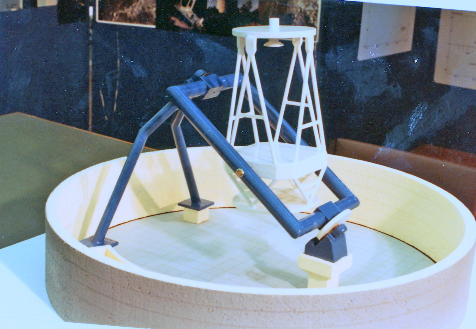
|
Model of the original mount.
Photo: Col Cochran |
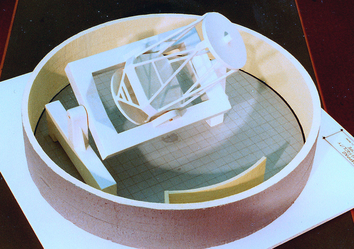
|
Model of the upgraded mount.
Photo: Col Cochran |
The telescope tube was shipped to Contraves Goerz, a US firm specialising in high accuracy telescope mount design. The open loop pointing accuracy of the new mount was about 1/3 of an arc second and could cope with the high satellite orbital velocities – about 6.5 minutes from horizon to horizon for close orbit satellites.
The telescope was reinstalled in the Orroral observatory and upgrades to the laser system and the receivers completed.
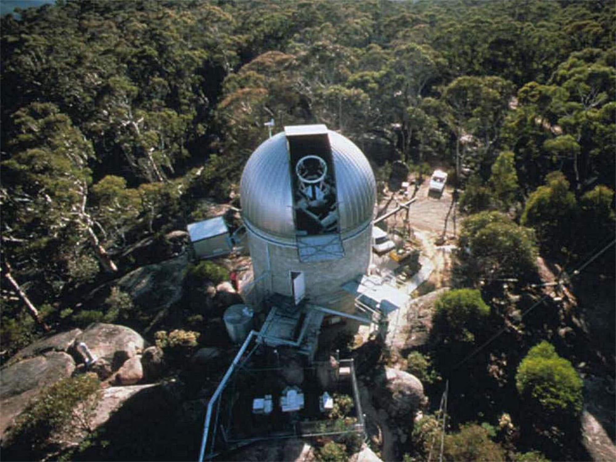
|
The laser observatory in 1983.
Photo: Philip Clark. |
The new laser was a frequency doubled Neodymium Yag with an output of more than 2 Gwatt at 5320 Angstroms and pulse length of a few tens of pica seconds. The receiver detector was the very latest Micro Channel Plate Tube overdriven to achieve the required timing accuracy.
The entire transmit / receiver system was aligned on an isolated and damped optical table, now, at the telescope Coude focus where it did not move with the telescope position. The actual transmitted visible green laser disc was 1.5 metres in diameter and about 3.5 mm thick at a repetition rate of 30 times a second.
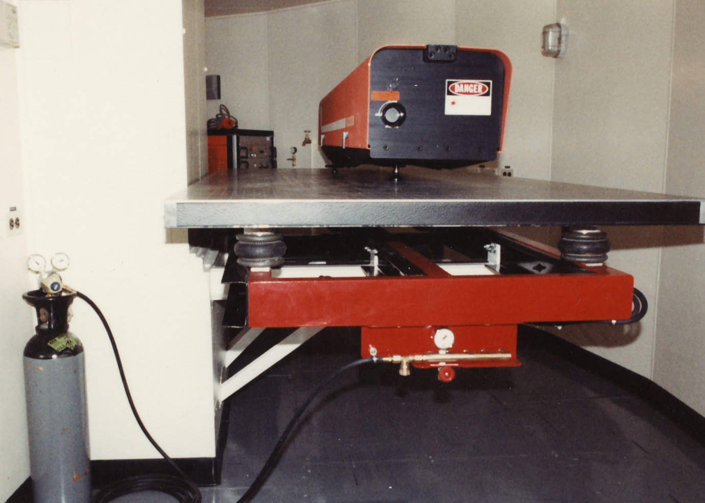
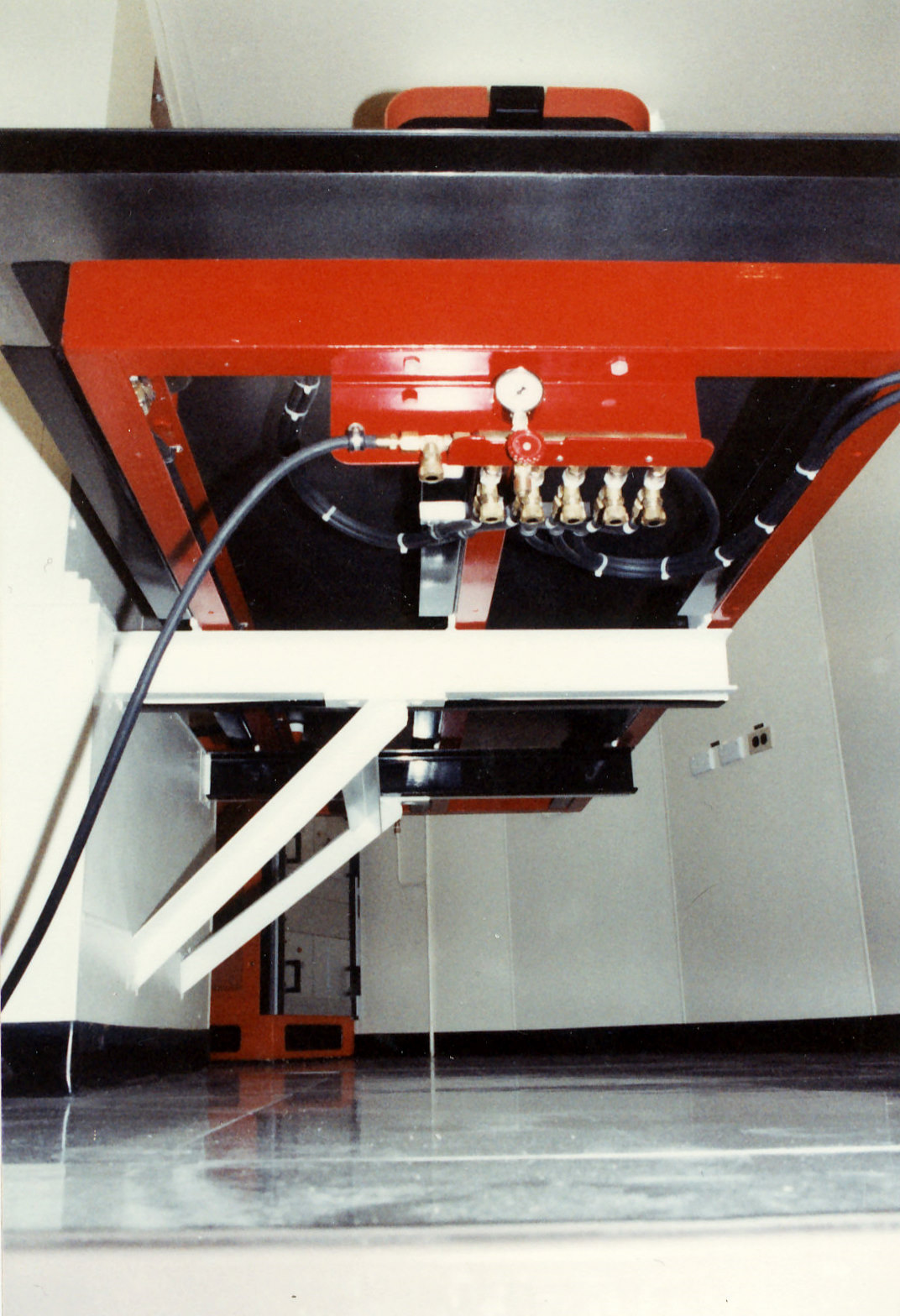
|
The optical table sat on self-levelling pneumatic cylinders supported by a constrained layer damped subframe cantilevered off from the isolated telescope pier.
Photo: Col Cochran |
|
Constrained Layer Damped Subframe.
Photo: Col Cochran. |
To obtain the pointing accuracy required, about 1 arc second, the telescope had to be mapped against the stellar background. Because of its own mass the optical axis varies, or flexes, from the encoded axes outputs. About fifty stars were used randomly distributed across the observable hemisphere. Open loop pointing was derived from the satellite ephemeris modified by the latest flexure map.
Satellite ranging commenced with immediate success and the station regularly determined the normal point satellite range with an accuracy of some 3mm and a precision of about 1mm.
Towards the end of Orroral, laser returns were detected from the lunar retro reflectors.
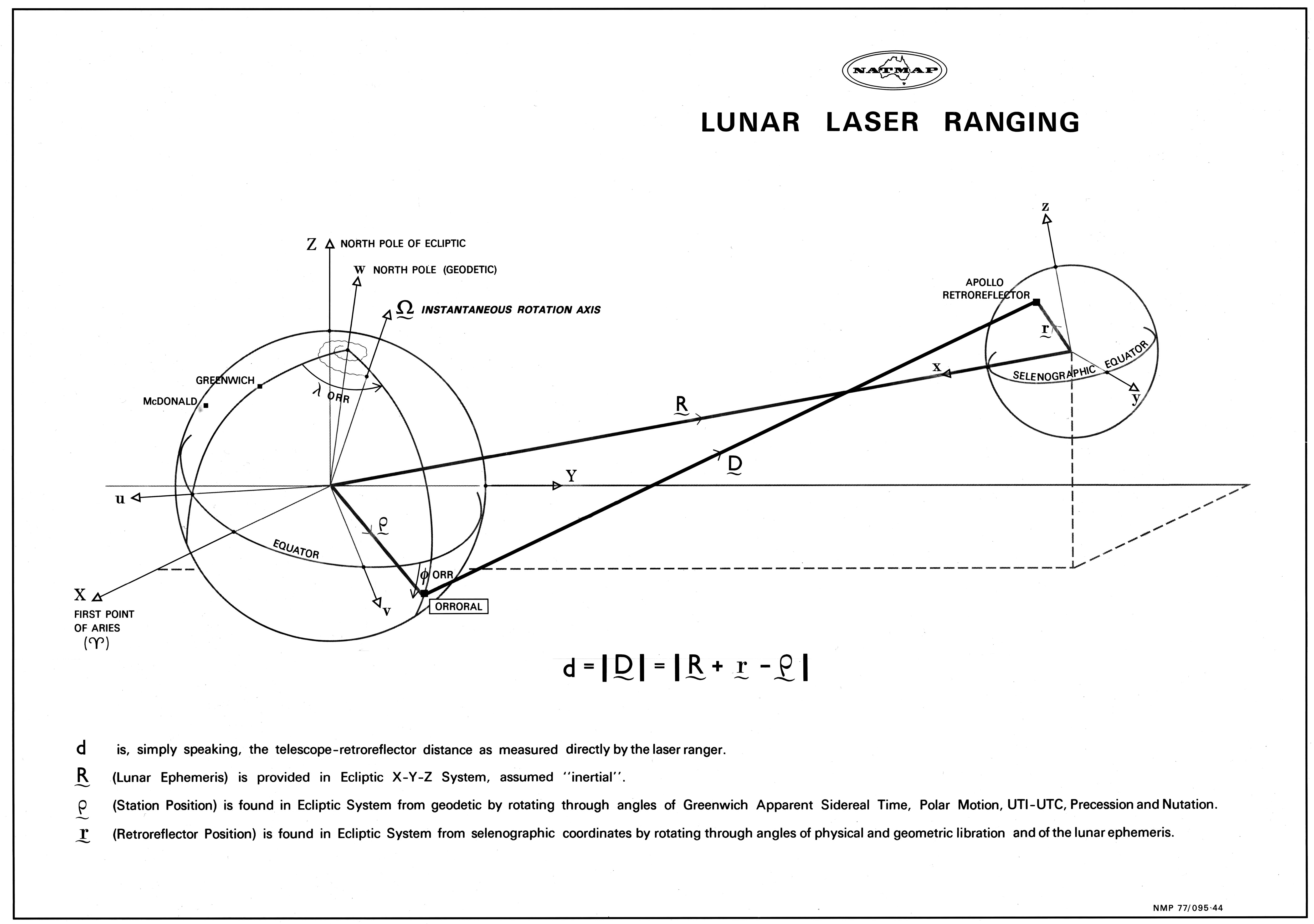
|
This 1977 poster on Lunar Laser Ranging from the National Mapping Authority was preserved by Hamish Lindsay and scanned by Colin Mackellar. |
To support NASA’s ranging requirement the station was manned with three shifts twenty-four hours a day and 365 days a year. Each tracking shift usually consisted of three staff with a permanent engineering day shift giving a total of around 13 staff.
The drive from Canberra to the site took about 1 to 1.5 hours each way depending on the driver and how he got out of bed that day. Often the whole track from the valley floor up to the site was thick mud and even snow sometimes, which made the trip up the hill somewhat interesting, although, fortunately a vehicle was never lost there. Other incidents designed to rudely awaken the passengers were flooding of the causeways across the Orroral River and numerous kangaroo and wallaby near misses. Only twice had staff to stay over one day because of flooding.
|
The Laser Observatory.
Photo: Col Cochran. |
The establishment of the Observatory was nearly entirely due to the efforts of National Mapping’s Geodesist Dr. Peter Morgan, the first Station Director, and his negotiation with the Smithsonian Institute and NASA.
Orroral made a significant contribution to the global satellite ranging experiment as most of the fixed NASA stations were in the Northern Hemisphere and so imposed a bias on the satellite ephemeris predictions. The results of that experiment provided data on the earth’s gravitational field and earth tides among others.
The station was closed in 1998 and its duties taken over by Electro Optics Systems, an Australian firm which now operates and maintains it on behalf of the Geoscience Australia.
_____________
Timeline
This very helpful timeline is extracted from “HISTORY OF SATELLITE LASER RANGING IN AUSTRALIA”, published online by the Goddard Space Flight Center using material originally prepared in March 2004 by John Pugh of Geoscience Australia. (Thanks to Kerrie Dougherty for the link.) Highlights added in bold.
1973, March: Agreement signed between Australia’s national mapping (natmap) and NASA under the USA-Australia hornig treaty for co-operation on the construction of a lunar laser ranging facility at Orroral in ACT, further up the valley from the SAO facility.
1973: Start of approval and planning process for the construction of Orroral geodetic observatory for lunar laser ranging.
1974: Telescope and ruby laser transferred from Mt Lemmon in Arizona to Orroral by NASA.
1975, March: Orroral building commissioned after co-operation in construction and equipping between Natmap, NASA and SAO. Construction contracted out with operation of facility by Natmap personnel.
1981: Contract signed between Natmap and NASA to convert Orroral to lunar and artificial satellite laser ranging.
1983: New telescope mount, ND:YAG [Neodymium Yag] laser and upgraded computerised operation system installed at Orroral.
1984: Conversion of Orroral from lunar laser ranging to lunar and artificial satellite laser ranging completed.
1998, 31 Oct: Satellite laser ranging ceased at Orroral.
1998, 30 Nov: Orroral site vacated.
1999, 11 May: Orroral telescope dispatched to White Sands, New Mexico, USA, for use by NASA.
1999, 29 Nov: Orroral facility demolished leaving observatory building and dome intact. Site restored to nearly original condition.