MILA – Merritt Island Launch Annex – Tracking Station
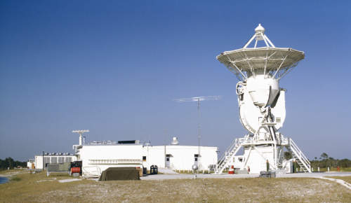
MILA (Merritt Island Launch Annex) Tracking Station, adjacent to Kennedy Space Center, 1967. Looking north. Photo: Bill Wood. |
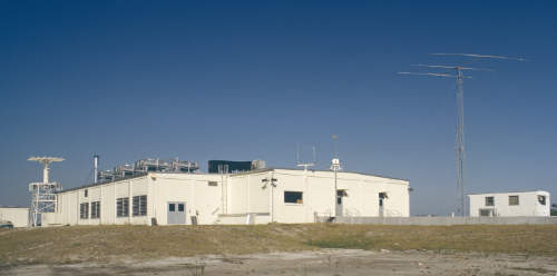
MILA Ops Building, looking north, viewed from next to the USB antenna, 1967. Photo: Bill Wood. |
In 1966, the Merritt Island Launch Annex (MILA) Tracking Station was established adjacent to the Kennedy Space Center to support Apollo launches and Earth-orbital phases of the missions.
MILA was located approximately 9.5km SSW of the VAB and 2km SW of the Kennedy Visitor Center Complex. The former site, on S-Band Road, is just north of the intersection with Ransom Road.
During Apollo, MILA (along with Corpus Christi) received live slow scan television from Apollo 7. These pictured were seen live across the USA.
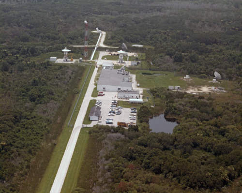
Over the years, MILA’s capabilities were expanded, including the installation of a second 9-metre USB antenna.
In 1979, an auxilary site at Ponce De Leon, about 60km north, was established to assist in the tracking of space shuttle launches. (The exhaust of the Shuttle’s SRBs interfered with tracking, so a second site was needed for diversity.
In 1980, addition antennas were added for TDRSS support.
This aerial photo of MILA was found in the Tidbinbilla archives. It’s looking roughly south. A second 9 metre antenna has been added (the one on the left near the tower). Undated but probably 1980s. ID and scan by Colin Mackellar. |
More to come on this page.


