Maps and info on Carnarvon Tracking Station


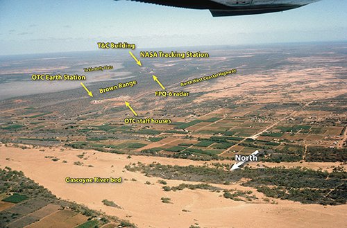
To avoid confusion...

The NASA Tracking Station and the OTC Satellite Earth Station at Carnarvon are often confused in popular thinking.

They were two different installations with different purposes, at either ends of Brown’s Range. The OTC station was at Carnarvon in order to provide communications between the NASA tracking station and the Goddard Space Flight Center in the US. The OTC station was not involved in the tracking of spacecraft.

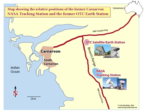
For a larger version of this map (390kb PDF), click the image.


OTC(A) Carnarvon

Guntis Berzins (OTC) took this aerial photo from just to the NW of Carnarvon at the end of 1966. It shows the relative positions of the OTC(A) and NASA stations.

Click the image for a PDF file.


map

Carnarvon Tracking Station Layout

from a Department of Supply booklet scanned by Stuart Wattison.

(Here’s the same map rotated so that North is at the top.)


map

Carnarvon Tracking Station Booklet

produced by the Department of Supply – scanned by Stuart Wattison.
3.5MB PDF by Colin Mackellar.

The booklet seems to date from early 1973 – after the Apollo Program, Carnarvon (and the other MSFN stations) became part of the STDN.

More to come