
C005. – Track into Honeysuckle, June 1964.
This very underexposed slide needed the levels pushed to see anything at all – hence the poor quality.
Transparency from the Tidbinbilla archives.
Scan: Colin Mackellar.
Honeysuckle Creek early site visits
As part of the site evaluation, many visits were made to Honeysuckle Creek before the final site location decison was made.
Where possible, dates and names have been added, and any text on the original photos / transparencies. If you can help fill in any missing names or details, please make contact. Thank you!
|
C005. – Track into Honeysuckle, June 1964. This very underexposed slide needed the levels pushed to see anything at all – hence the poor quality. Transparency from the Tidbinbilla archives. |
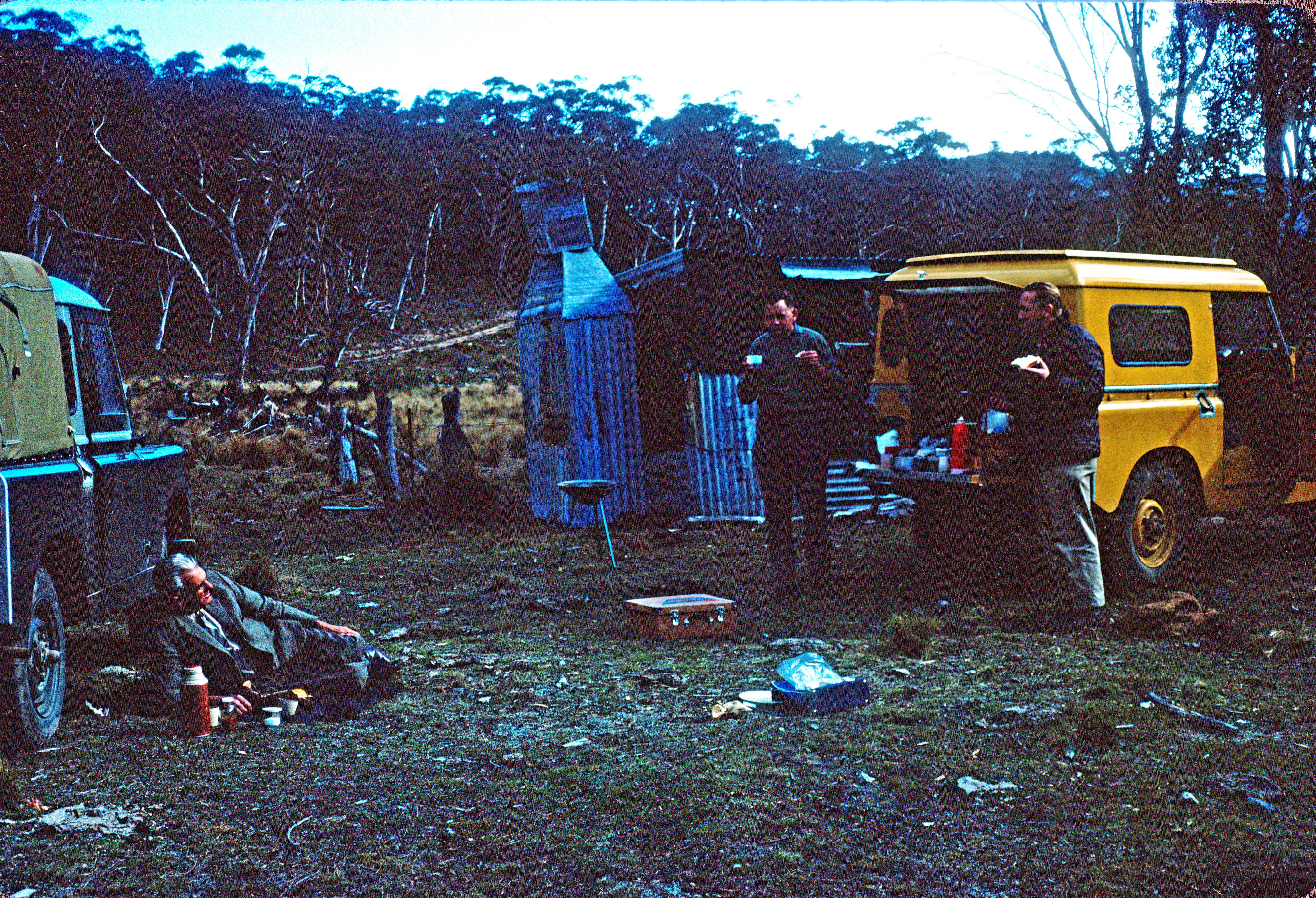 |
C001. – Lunch at the “Honeysuckle Hotel”, June 1964. This very underexposed slide needed the levels pushed to see anything at all – hence the poor quality. It shows WRE Facilities’ boss Lance Sharp, centre, with two companions, beside a shepherd’s corrugated-iron winter shelter later nicknamed the Honeysuckle Hotel. The Honeysuckle road would be later built following this farm track. (See the next image.) Transparency from the Tidbinbilla archives. |
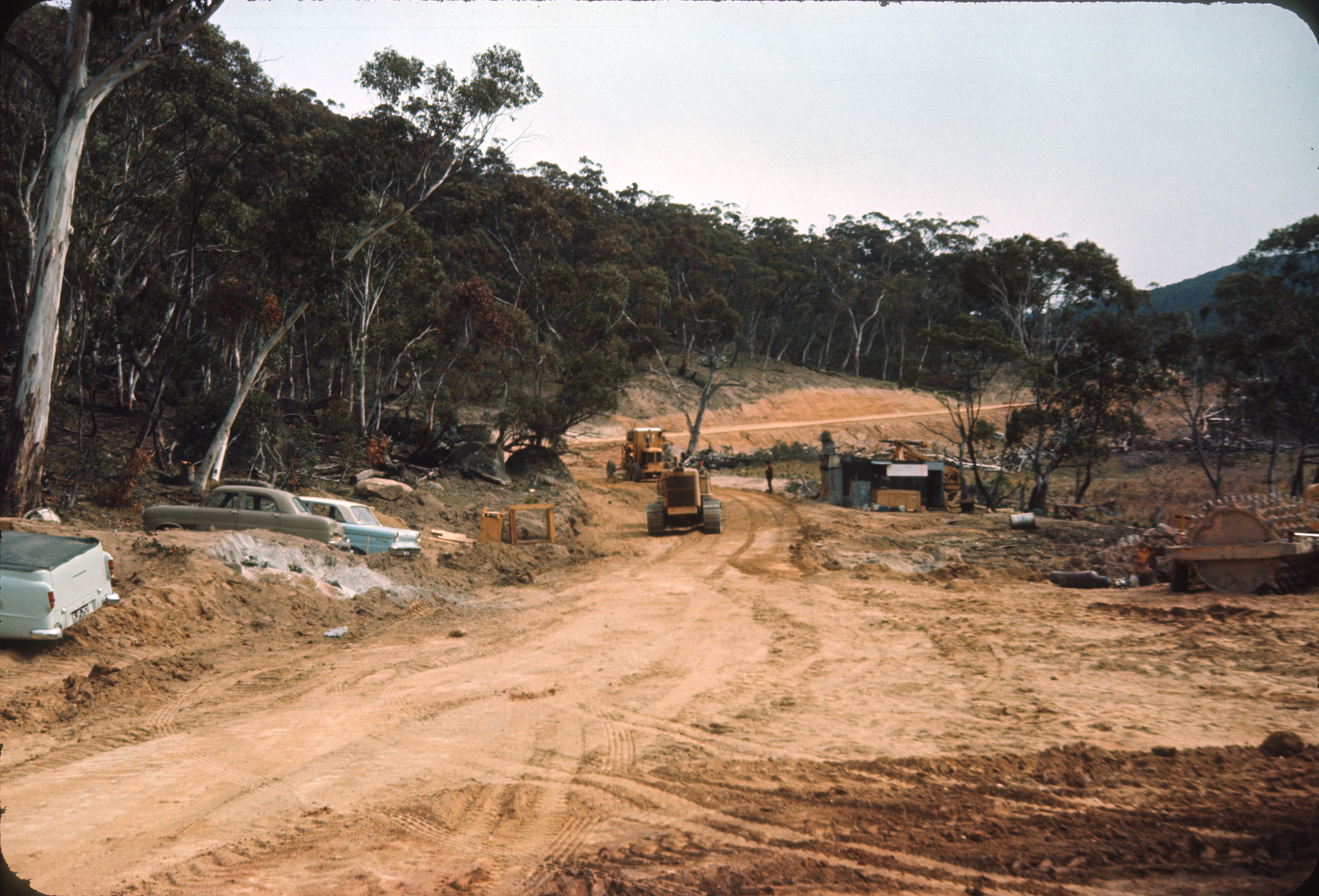 |
C.139 – Much later, probably late 1966 or early 1967, the road to Honeysuckle passes the “Honeysuckle Hotel”. Undated transparency from the Tidbinbilla archives. See also this even later photo by Rhelma Lawrence. |
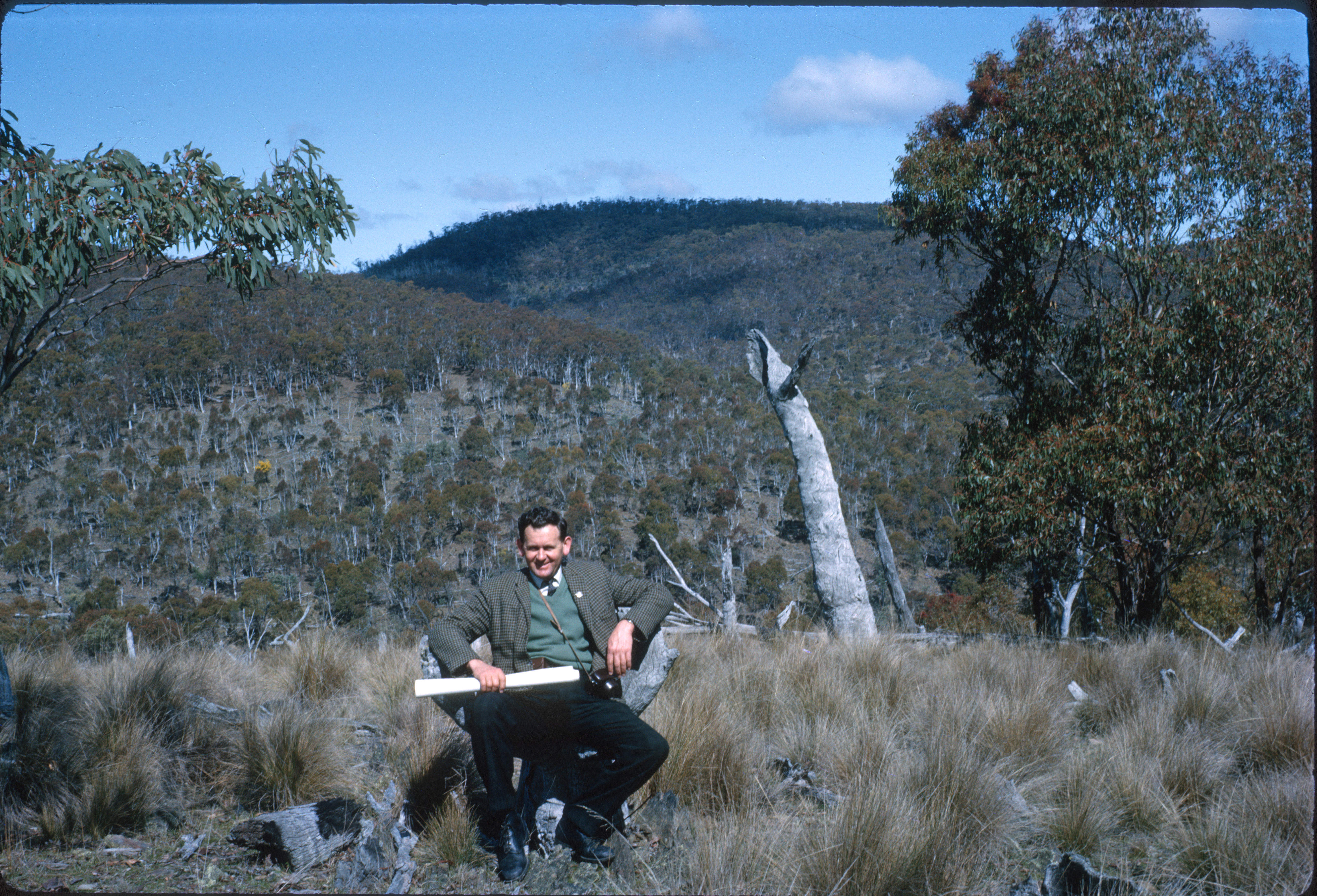 |
C031. September 1964 – WRE’s Lance Sharp sits in an “Apollo Armchair” treetrunk somewhere on the proposed Honeysuckle Creek site. Transparency from the Tidbinbilla archives. |
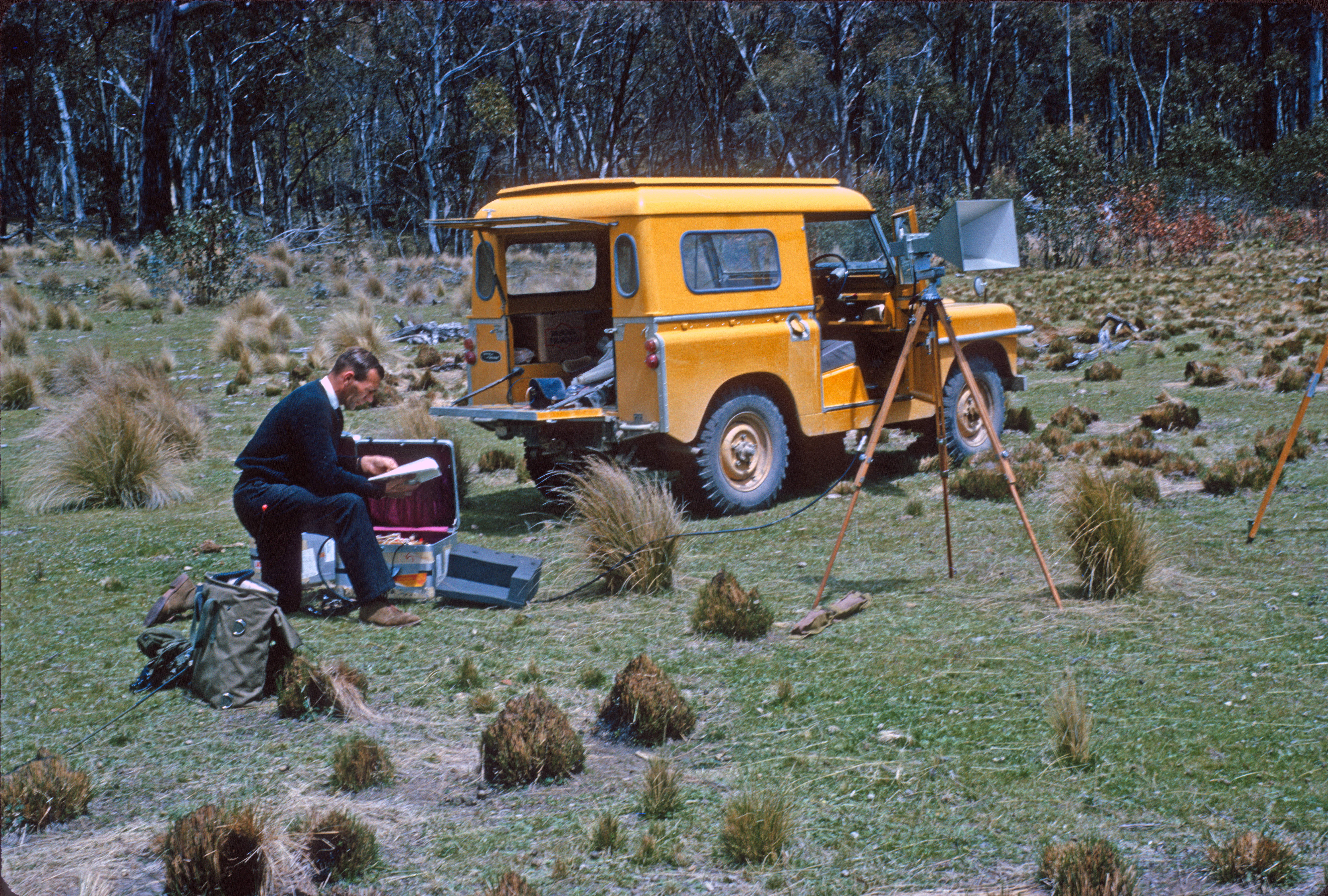 |
C044. – Honeysuckle S-band RF measurements October 1964. Transparency from the Tidbinbilla archives. |
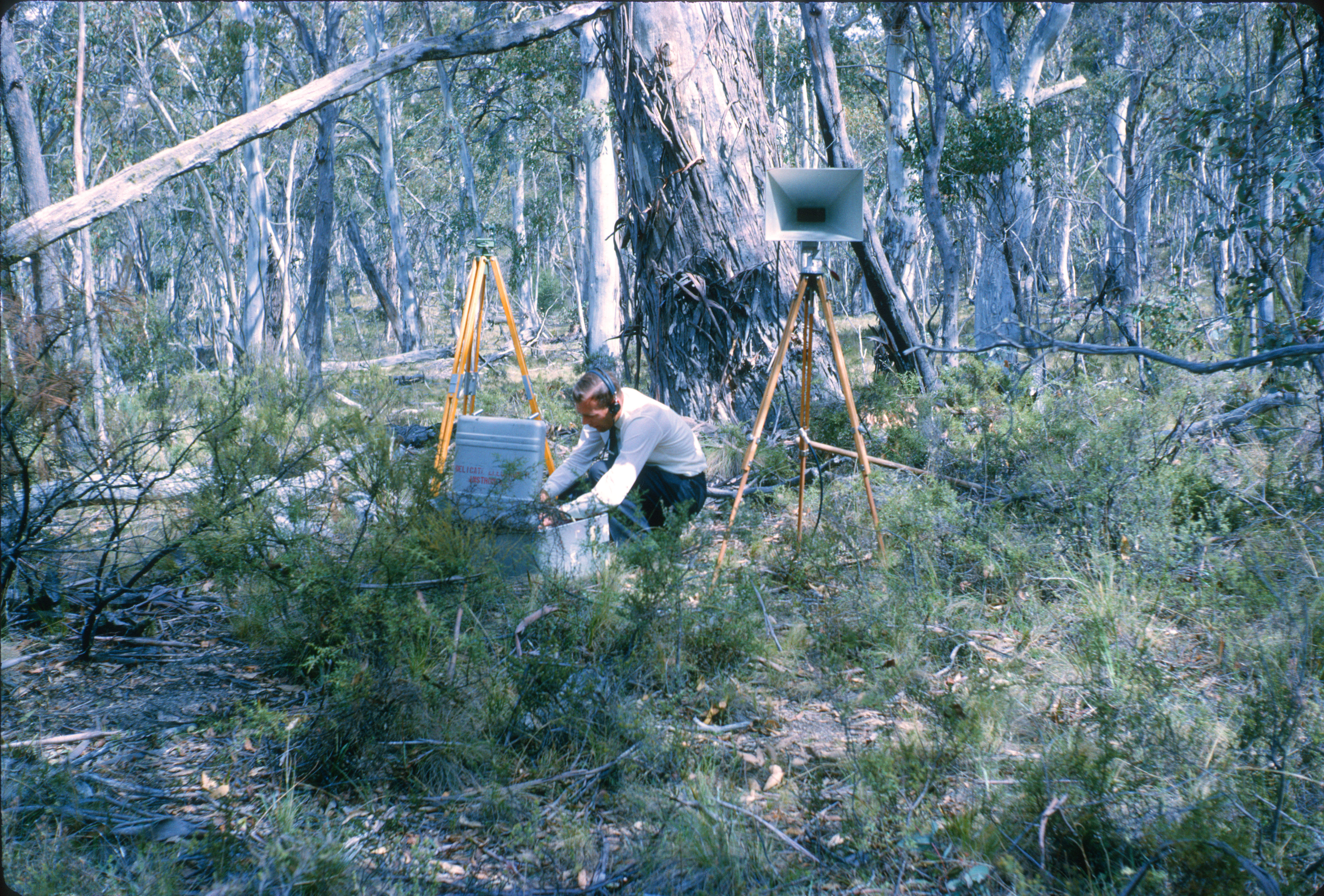 |
C045. quarter mile west of clearing looking south. Undated transparency of RF testing – from the Tidbinbilla archives. |
 |
C036. – quarter mile west of clearing looking north October 1964. Transparency from the Tidbinbilla archives. |
 |
C039. – Honeysuckle Ridge 200 yds SW Bucks Boulder looking towards DAF October 1964. “Buck’s Boulder”, named for NASA Associate Administrator Edmond C. Buckley, the man most responsible for the setting up of the Manned Space Flight Network, was somewhere near the site of the Collimation Tower, overlooking Orroral Valley and the DAF (Data Acquisition Facility – i.e. Orroral Valley Tracking Station which was under construction at the time). Transparency from the Tidbinbilla archives. |
Much more to come on this page.